Ottawa, October 19, 2015
Stage Three—Hungarian Homecoming
Since both
Slovakia and Hungary are in the EU and in the Schengen Zone, there were no
border formalities on Sunday, June 14 as we rode over the road bridge into Hungary, very unlike the situation in 1988 when crossing the border
required a visa and lengthy formalities with stern border guards; I still
remember my friend Jeremy getting turfed off the train back to Budapest after a
weekend in Prague because his Hungarian visa wasn’t multiple-entry; we didn’t
see him again for several days. The main
difference between the two sides of the border is currency; unlike Slovakia,
Hungary still uses its own money, the forint.
At about 300 forints to the euro, there are a lot of zeroes involved,
and when we went to an ATM to draw out some forints, these zeroes were Terri’s
downfall. It was my turn to take out
money, but the ATM didn’t like my Swiss bank card, so Terri used her New
Zealand bank card instead and took out 300,000 forints, thinking it was about
100 euros; instead, it was worth about 1000 euros. Terri ended up bankrolling our entire trip
through Hungary for both of us and still having most of the forints left over
at the end. She was not amused!
Riding through
Hungary on a sultry Sunday afternoon, there was little traffic and, since
Hungary has strict Sunday closing laws, we rolled through ghost towns. We stopped off for radlers a couple of times,
fortifying this with soup the second time, before arriving at the historic town
of Esztergom around 4:30.
 |
| Wild boar stew in Esztergom |
The campground
there featured a swimming pool, and Terri, hearing that it closed at 6 pm,
raced off immediately to leap in. It
felt indescribably soothing to dive into the cool water and re-equilibrate our
bodies after the sapping heat of the day.
The campground had a restaurant serving wild boar in red wine sauce, and
we tucked into that, washed down with some fine Hungarian red wine. Restored to life, we went for a walk after
sundown across the bridge into Slovakia to admire Esztergom Cathedral from the
other bank, lit up and looking grand.
The church is the centre of Catholicism in Hungary and looks the part,
with a huge neo-classical dome rising high above the town like St. Peter’s in
Rome.
 |
| Esztergom by night |
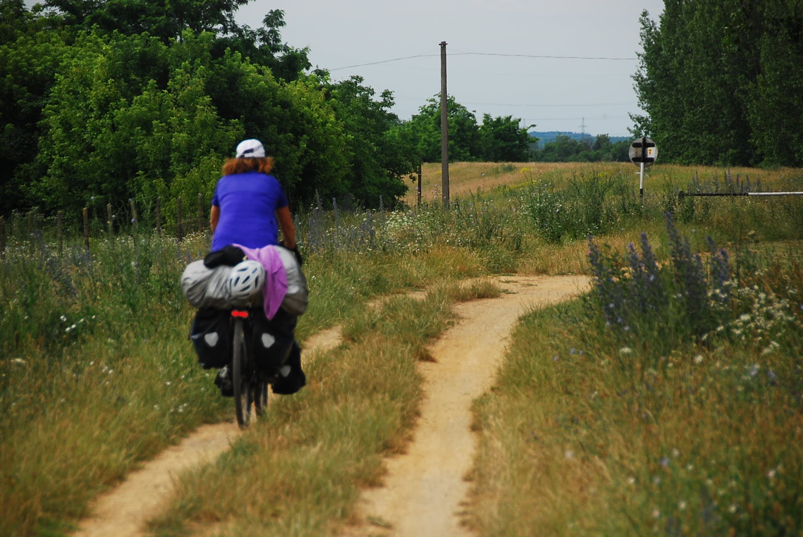
After the
previous day’s exertions, we had an easier time getting from Esztergom to
Vac. On our way out of town, we found a
EuroVelo 6 sign for the first time in a long while, directing us down to the
Danube where a ferry crossing took us across to the left bank. Talking to other cyclists waiting for the
same ferry, I had a good look at the detailed EV 6 route atlas that they had,
and we decided that we had to get the next volume, leading from Budapest to
Belgrade. It was wonderfully detailed,
and looking at it, we saw that our route into Budapest shouldn’t be as grim as
it had looked on my road map.
 |
| Our unexpected ferry ride across the Danube |
The ferry
put us ashore and we had an easy, pretty ride along bike paths to the village
opposite Visegrad, where we stopped and had langos,
those deep-fried flaps of dough that I used to love in my Budapest days, and fagylalt, the ice cream that Hungarians
consume in vast quantities in the summer.
We briefly contemplated taking the ferry across to see Visegrad up
close, but decided that it was prettier from a distance. I remember hiking up to the top of the old hill-top
fort in 1988; it was a wild and desolate place in mid-November with great views
in all directions. This stretch of the
Danube from Esztergom through Visegrad and Vac to Szentendre is called the
Danube Bend (the river moves from being an east-west river to a north-south
one) and played a key role in Hungarian history, especially during the time
when the Ottoman Turks dominated most of the country and the Danube Bend was
one of the regions still free of Turkish rule.
 |
| Vac, city of churches |
We rolled
easily into Vac, arriving in early afternoon and, in view of the gathering rain
clouds, keen to sleep indoors. We tried
finding a private room to rent through the tourist office, but they were
overpriced. I spotted a sign for a
cheaper option and so we found ourselves staying as guests in a museum that had
had its government funding cut and had turned some of its rooms into hostel
accommodation; 4400 forints (about 15 euros, less than an Austrian campground)
got us our own room. We checked in and
then went out for a poke around the town.
I had never been to Vac before, and was pleasantly surprised by its
Baroque loveliness. It abounds in
churches, and its main square is a very pretty spot, full of families eating
ice cream and watching small children play peacefully. We demolished a pizza of truly monstrous size
and lamented that the biggest attraction in Vac, the Mummy Museum, was closed
on Mondays and Tuesdays.
 |
| Seriously hungry in Vac |
I had seen a
presentation years before about the DNA analysis of the bodies of hundreds of
people buried in a crypt of the Dominican church in the 1700s and then
forgotten until renovation work knocked a hole in the crypt wall. The pine coffins and microclimate in the
crypt almost perfectly preserved the bodies from decay, and scientists were
able to figure out a lot of interesting information about diseases such as
smallpox and tuberculosis. I was keen to
see them, but the schedule conspired against us. Instead, on a suggestion by the museum
curator, we went for a walk into the nature preserve along the bank of the
river, where a forested swamp sheltered lots of birdlife. On our brief exploration, we spotted two
different types of woodpeckers, lots of nightingales and (sadly) hordes of
biting insects. Despite the mosquitoes,
however, it ended up being a real highlight of the trip, standing silently on
the boardwalks leading through the marsh, listening to the cacophony of
birdsong.
 |
| Birdwatching outside Vac |
Our ride into
Budapest from Vac the next day was a tale of two halves. With only 50 km to cover, we thought it would
take under 3 hours to get to the tourist flat we had booked over the internet. It all started promisingly, with a ferry at 9
am leading us back to the right bank. We
rolled across an agricultural island that provided us with a fruit feast
(cherries and more watermelon), then followed EV 6 signs along a bike path that
degenerated into a rough forest track and a serious mudhole before suddenly
spilling us out into Szentendre, the artists’ colony just north of
Budapest. We left the bikes and wandered
around the atmospheric streets, very much cleaned up and gentrified since I was
last there in 1988. More bike paths led
us into the far northern suburbs of Buda, where radlers and ice cream revived
us for what should have been a simple trundle through the streets to our
apartment.
 |
| Riding along the bike paths from Vac to Budapest |
Instead it
ended up taking us well over two hours to find our way the 14 km or so that
separated us from our destination. We
lost the EV 6 signs, spent a lot of time looking for them, then tried to
improvise a route along the Pest bank of the Danube (very, very
unsuccessfully). We finally ended up
slowly rolling along side streets, trying to keep out of the crazy traffic of the
main avenues, and when we got to our apartment building, we couldn’t find the
door or figure out how to get in. A bit
of re-reading e-mails and we figured it out.
It was a small apartment (a larger flat had been cut in half) but a
decent price for central Pest. We had a
late lunch of kebabs and then headed into Buda to meet a friend of my friend
Kent, Peter. He works in a graphic
design firm and was having a wine and cheese evening with some friends. We hit it off immediately and sat around
eating fine cheese and sipping lovely wine and discussing the state of
current-day Hungary. Eventually
tiredness, the curse of the bike tourist, hit and we said our goodbyes to catch
a bus back to our flat.
 |
| Nighttime along the Danube in Budapest |
We took a
proper day off the bikes in Budapest the next day. Since Terri and I had both explored the city
in the past, we went in for strolling the streets rather than a series of
museums, although I had to visit the Terror Haz, the brilliant museum occupying
60 Andrassy Ut, the former headquarters of both the Nazi-era and Communist
secret police forces. We walked through
the chic streets of central Pest, went looking (unsuccessfully) for a new seat
for Terri’s bike (her gel seat was starting to hurt a lot by the end of every
day in the saddle), bought the map book for the Budapest-Belgrade leg of our
journey, searched for my old favourite pub, the Fregatt (sadly closed during
the day), looked in at the wild urban-ruin-themed Szilta Kert club, and ended
up lunching late at the Khao San Road-esque food court outside Szilta
Kert. We then walked through the Terror
Haz and both of us found it very moving.
Having visited similar museums in the three Baltic capitals, I would
have to rate this one as being the top of those 4 in terms of humanizing the
victims and explaining the larger picture.
While Terri went back to the apartment, I stopped in at the hospital to
get my hand X-rayed. Luckily there were
no broken bones, although now (3 months later) it’s still sore and doesn’t
close properly. We ate takeout kebabs, then went downtown with a bottle of wine
to walk over the Danube bridges and along the river bank, enjoying the lit-up
castle and parliament buildings and scouting our escape route for the next
morning. It was a fitting farewell to
one of Europe’s most beautiful capital cities.
 |
| Szechenyi Chain Bridge with Buda Castle |
In contrast to our
agonizing entrance to the city, leaving Budapest was a piece of cake, with lots
of EV6 signs and our new route atlas to fill in the occasional gap. We meandered down the left bank of the river,
past areas that had been completely rebuilt since my last visit. Csepel Island, once a hotbed of heavy
industry, was peaceful, with decaying factories separated by pleasant green
stretches and lots of rowing and canoeing clubs. As we got further from downtown, the houses
got a bit fancier, as people renovated old places that were both within
commuting distance of the city and perfectly located on one of the channels of
the Danube. Our progress was marked by a
radler and peanut stop after 28 km in Szigetszentmiklos, and lunch
(“gipsy-style pork”) in an upmarket pizza restaurant after 51 km in
Rackeves. We left Csepel island finally
and crossed to the true left bank of the river, where we rode partly on quiet
back roads and partly, propelled by a strong tailwind, along the main Route 51
from Budapest to the Serbian border. We
were looking for a spot to camp wild, but then saw camping signs near
Szardszentmarton and followed them towards the Danube bank. There was no campground to be seen, but there
was an artificial lake with what looked like the burnt-out remnants of a
campground reception building. It took
us a while to figure out how to get in, but once we did it was a perfect spot
to sleep, with cooling breezes off the lake, no traffic noise and lots of space
to spread out. We cracked out the little
toaster rack that I had been carrying and made toasted grilled cheese
sandwiches and soup, and slept well in our tent after a pleasant 84 km from
Budapest.
 |
| Toasted grilled cheese sandwiches |
The next day we
made more toast for breakfast to accompany our muesli, then rolled off
southwards. We took the main highway for
a while as far as Dunavecse, then took a series of back roads and dirt tracks
to Dunaegyhaza and on into Solt. Along
the way we spotted numerous stork nests atop telephone poles, some with two or
three juvenile storks in them, and occasionally a parent as well. Storks ended up being a recurring leitmotif
throughout our Danube journey. We took a
lovely diketop cycle path as far as the town of Harta, where we ducked into a
restaurant to avoid an oncoming rain squall.
The pork paprikas hit the spot and we used the restaurant wi-fi to book
return plane tickets to Geneva from Sofia, Bulgaria, which we decided was a
realistic ending point for our ride. On
our way out of town we met up with two fifty-something Liverpudlians who were
on the fifth year of a six-year, 9-days-a-year mission to ride the entire
length of the EV6 from the Atlantic to the Black Sea. We raced along another dike-top cycle path,
then parted ways with the Scousers as we took quiet back roads to Fokto and
into Kalocsa, the paprika capital of the world.
Sadly we arrived too late for the paprika museum, and had problems
finding a place to stay indoors, with more rain threatening. Eventually we put up in a downtown hotel
where 5000 forints (roughly 17 euros) bought us a comfortable double bed and an
exquisite shower.
 |
| Some of the dirt tracks we followed south of Budapest |
The next
morning, with the rain having cleared out the skies, we raced out of town in
the direction of an off-beat, off-the-Danube attraction mentioned in our
guidebook: the wine-press village of
Hajos. With a stiff tailwind, we
averaged 23 km/h all the way to Hajos Pincsek under clear skies; this doesn’t
sound like much if you’re on a racing bike, but on a fully-loaded touring bike
with more than 20 kg of luggage it was the best hour’s speed of the entire trip. Strangely enough, we passed barely a single
vineyard all the way. It was only after
we rolled through the actual village of Hajos and into the strange historical
capsule that is Hajos Pincek that we started to see vineyards stretching away
in front of us.
 |
| Storks, symbol of central Europe |
Hajos Pincek
consists of hundreds of tiny houses that aren’t really houses, at least not for
living in. Instead, every Hobbit-sized
building contains a wine press and a cellar carved out of the soft rock for
storing the product of the wine press.
This huge concentration of tiny wineries is one of the many results of
the Danube Schwabians, German-speaking farmers invited in by the Austrian
Emperors to repopulate deserted areas after the reconquest of Ottoman-held
lands in the 17th and 18th centuries.
 |
| In Hajos Pincek, with a few of the tiny wine press houses |
The Schwabians were famous for their hard
work and business acumen, and Hajos Pincsek was the site of many a successful
small business over the centuries.
Although the wineries fell into disuse after the upheavals of the Second
World War and the deportation of many of the descendants of the Schwabians by
the new Communist regime in the late 1940s, recently people have been reviving
the wineries, often as a hobby or as a profitable sideline from their full-time
jobs. We saw a few folks working away in
their wine houses, but only one house was really open, so we stopped in there
to sample some wine with the old lady running the place. The white wine was pleasant (more of the
Gruner Veldtliner that we had so enjoyed in Austria), and the red was light but
drinkable. We peeked down into the
cellar, full of past years’ vintages cloaked in a thick layer of mould. We bought a bottle for all of 1100 forints
(about $3.50) and then found a larger, more commercial outfit outside the
village to sample a bit more. We ended
up finding a very pleasant red called Schwabenlblut (Schwabian Blood) to put
into my panniers for later consumption.
 |
| Wine tasting in Hajos Pincek |
We cut back
southwestward along an undulating road (the least flat road we’d followed since
Krems) past more vineyards, and eventually out onto route 51 again. Traffic wasn’t too bad and we zipped along to
an early stop in the town of Baja, a pleasant town on a sidestream of the
Danube that our guidebook told us was another centre of Schwabian life. Our campground was right beside the water,
and was full of triathletes taking part in a series of races right beside
us. We watched for a while, then put up
our tent and set off carrying only cameras and water to explore a national park.
 |
| Exploring the national park close to Baja |
Across the
river from Baja is a park that is supposed to help preserve the swampy,
riverine forest beside the Danube. We
crossed to the right bank and immediately left the narrow, busy main road in
favour of the dirt tracks that run through the forest. It was an enjoyable place to explore, full of
birds (or at least birdsong; the birds themselves were hard to spot), fish,
snakes and even wild boars that left us a bit nervous, given their fearsome
reputations and the fact that they had young with them. Less welcome were the swarms of mosquitoes
that plagued us; I guess they help feed the fish, though, so they’re not
completely without merit, although it certainly seemed so as we swatted away at
them. As in Vac, it was a glimpse of the
rich natural world that once stretched the length of the Danube before
population growth and industrialization took their toll.
We slept
reasonably well despite the triathletes’ party going on in the campground that
evening, and arose ready to have a short, easy ride followed by a cultural
interlude. Our target for the day was
Mohacs, the border town only 38 km south of Baja. We started out with a spectacular
route-finding error on my part that left us pushing our bikes through
waist-deep grass on a path that hadn’t been used in years. Eventually Terri convinced me to turn around,
and we backtracked to where we had gone wrong several kilometres earlier. Once we got onto the right road, we raced
along easily along tiny farm roads and some dike-top paths all the way to the Mohacs
ferry crossing. The campground we had
been counting on turned out not to exist anymore, and with time ticking away,
we decided to take a room indoors somewhere.
It took much longer than it should have, but we finally found a little
oasis of genteel tranquility at a little private zimmer for 25 euros. We quickmarched back into town to the bus
station and caught a bus to Pecs to spend an afternoon poking around a city
that I fell in love with back in 1988.
 |
| Szent Istvan Ter, Pecs |
It felt strange
racing along in a bus, covering in an hour and a half what it would have taken
most of the day to pedal. We got to town
and walked into the centre of Pecs, popping out in the lovely Baroque town
square, Szent Istvan Ter, before continuing to the Csontvary Museum. I had discovered Csontvary, a brilliant and
eccentric Hungarian painter of the late 19th century, back in 1988 and
I wanted to introduce Terri to his dramatic huge canvases. As I had hoped, she was completely entranced
by his work, and we spent an hour and a half contemplating his paintings. Afterwards we went in search of some very
early Christian churches that have been unearthed (the town was an important
Roman frontier post and Christianity flourished here in the late Empire), but
couldn’t find them as that entire part of town had been taken over by a huge
music festival. We ambled back to Szent
Istvan Ter and ordered wine and ice cream, lingering over the view of the
neatly restored facades and the Ottoman mosque that is now the main church in
town.
 |
| Elegant afternoon refreshments in Pecs |
When we got back to Mohacs, we had
an unforgettable rooftop meal at the Szent Janos Hotel, watching the sunset
paint the Danube all the colours of the rainbow.
 |
| Rooftop sunset over the river in Mohacs |
The next
morning, Monday, June 22nd, we left Hungary after an unforgettable week of
reigniting my affection for the country and its culture and people. On the way to the Croatian border, only 15 km
south of town, we stopped briefly at the memorial to the Battle of Mohacs, the
1526 debacle in which the Hungarian army was cut to pieces by the Ottomans and
the inept King Lajos drowned in a swamp while running away from the
battle. The battle left the road to
Budapest wide open, and the Turks duly occupied the capital for the next 160
years, a dark period in Hungarian history, at least from the modern Hungarian
perspective. Unfortunately, since we had
just changed all of our forints into euros, we didn’t have any money to pay the
admission fee, so we contented ourselves with a picture outside and then
pedalled into Croatia.
 |
| Memorial to the Battle of Mohacs, 1526 |


