Showing posts with label peninsula. Show all posts

Monday, April 16, 2018

New Zealand, March 2018: Down the East Coast

Lipah, April 16th

To see a Google Map of this part of the trip, click here.

Once we had headed south from Algies Bay and left the Northland behind after two enjoyable weeks there, Terri and I set off on a tour of the east coast of the North Island.  We had an appointment to keep on March 12th with Terri's sister Karen in Wellington, but other than that we were fairly unconstrained in our schedule.  Since this was the part of New Zealand that Terri had grown up in, there were plenty of family, friends and mementoes of her youth for us to visit, inbetween hikes, scenic detours and birdwatching.

Bar-tailed godwits at Miranda
We passed through Auckland's sprawl with only one stop, buying homebrewing and winemaking equipment at a shop that was billed as Home Growing and Home Brewing.  The guy at the till clearly was a keen home grower and had been sampling his own wares; he was too stoned to be of much help in answering questions.  We bought what we could, then headed east towards the Firth of Thames, through pretty rural villages surrounded by horse farms.  The Firth of Thames is a major bird migration site for waders, some of whom spend the rest of the year in Alaska.  The main birdwatching spot is at Miranda, and the Department of Conservation have done sterling work in setting up bird hides and staffing the place with very knowledgeable volunteer ornithologists.  We spotted the New Zealand endemic the wrybill, the royal spoonbill, the red knot and the bar-tailed godwit.

Thousands of godwits take to the air at Miranda
The godwits are the world champions of long-distance migration; when they leave New Zealand they fly to East Asia for refuelling, then on to Alaska.  Coming back, they fly non-stop across the Pacific, covering 11,500 kilometres in 10 days, for an average speed of nearly 50 km/h.  It's an astonishing feat of endurance for a bird with a mass of only about 400 grams.  Sadly, rampant draining of wetlands for industrial development in China and South Korea is depriving them of their refuelling stop there, and godwit numbers, along with those of many other migratory waders along the East Asian Flyway, are in precipitous decline.  It was heartening to see so many birds at Miranda, and the efforts that New Zealand is undertaking on their behalf; it would be nice if South Korea and China were to put out the same effort.

Terri and her cousin Mark, keen adventure racer and cyclist
From there the grey skies started to open up on us, making the drive through the scenic Karangahake Gorge a bit less picturesque.  It's an old gold mining area, and we were en route to the town of Waihi, where gold is still mined today, to visit Terri's cousin Mark.  We stayed a couple of nights with Mark, whose father Ian was the younger brother of Terri's father Jim.  We had a fun night hearing about Mark's various adventure races, both those that he organizes and others in which he's a participant.  

The next day we headed out on bicycles to ride along with friends of his who were passing nearby as part of the Tour Aotearoa, a bicycle "brevet" (not exactly a race, but like a race) along the 3000-kilometre New Zealand Cycle Trail, a mixture of beaches, back roads, logging roads, old rail lines and single track that links Cape Reinga to Bluff (the entire length of the NZ mainland).  The Tour Aotearoa is a clever marketing event, staged every two years, sending out groups of 100 cyclists at a time from Cape Reinga.  We had breakfast with Mark's two friends at a cafe in Hikutaia, then rode 20 kilometres chatting with them about cycle touring and their experiences so far.  It was great to be back on a bicycle saddle and talking with other keen cycle tourists; Terri is certainly thinking of riding a good chunk of the trail sometime in the next couple of years.  We pedalled back through the Karangahake Gorge, which was much prettier in the sunshine.

Terri, her aunt and uncle and three cousins (and one husband)
The next day we met up with the rest of Mark's siblings along with their mother and father, all of whom live in Waihi.  It was great for me to meet them, and for Terri to get a chance to talk to them outside the context of funerals, which is sadly where they had been meeting over the past few years.  After a long, spirited conversation at a cafe, we bit them a fond farewell and headed off north towards the Coromandel Peninsula, a place dear to New Zealand hearts for its wilderness and its hippy, off-the-grid reputation.  The first port of call was the town of Whangamata, where Terri's parents had moved back in the 1990s so that her father could do more fishing in the ocean.  We found a couple of the houses that her parents had bought and renovated, took a few photos, then drove further north towards the most touristy place we had yet visited, Hot Water Beach.  For the first time in our travels, we entered into the raging torrent of overseas tourists in campers and campervans who wash over New Zealand every austral summer.  The beach has a trickle of geothermally heated water just below the surface of the sand, so if you dig a hole in the right spot, you are rewarded with your own hot spring.  The problem is that with too many people on the beach, all the right spots are taken, so you end up with lineups of hopeful bathers vulturing around, trying out abandoned holes and waiting for others to leave.  The water was pretty hot, but not very deep, as the sand constantly falls into the hole and refills it.  It was kind of fun, but not nearly as satisfying as I have had in Japan, on places like Shikine Island south of Tokyo.

Cathedral cove on the Coromandel
From there the tourist trail runs a bit further north along the rugged coast to Cathedral Cove, or rather to its parking lot, inconveniently located several kilometres from the trailhead, presumably as a means of forcing people onto overpriced shuttle buses.  We skipped the buses and walked briskly, racing the 6:30 closing time for the parking lot, out over the headlands to the cove.  It was definitely photogenic, but the grey skies robbed the rock faces of their colours.  We walked back along the beach trail into town, beating the deadline by half an hour, and then drove off to figure out where to spend the night.  We ended up opting for a DoC campsite on the other shore of the peninsula at the foot of the hike to the Pinnacles.  After a stop for fish and chips, we drove over a sinuous mountain road through dense fog, a white-knuckle experience amplified by passing the site of a spectacular multi-car accident.  When we finally arrived at the campsite, we found signs announcing that the Pinnacles track was closed due to storm damage, and our campsite looked very wet and unappealing in the continuing rain.  We ended up bedding down on our air mattresses under the shelter of the roof of the closed information centre.  It was a cozy, dry place, but no sooner had we fallen asleep than a carful of drunks arrived, car stereo blaring and loud voices slurring imprecations.  We stayed out of sight, hopeful that it wasn't a modern-day incarnation of Jake the Muss and his friends from Once Were Warriors, and they drove off soon afterwards.

New Zealand dotterel on the shore at Matarangi 
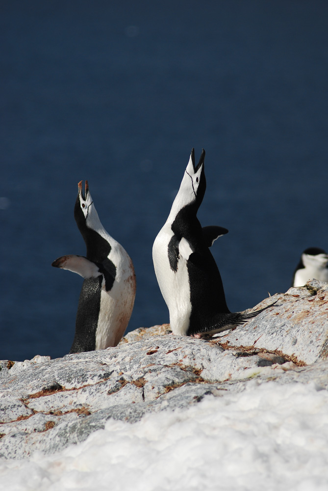
It was still raining the next morning, so we packed up the car and headed into the regional centre of Thames for breakfast and then further up the west coast of the peninsula.  The road was under heavy reconstruction after storm damage from a January cyclone, but the scenery was very pretty.  We ended up near the northern end of the peninsula in Coromandel Town, a hippy centre set in the midst of postcard-perfect sheep farms, then headed south along the east coast of the peninsula in search of a rare endemic bird species, the New Zealand dotterel.  In the small, pretty town of Matarangi we parked and walked along the wild, deserted, wave-tossed beach for a long way Terri spotted a dotterel in the distance.  We stood and watched through binoculars as it slowly worked its way along the sand, then realized that there was another one further back, and then two fluffy chicks.  It was heartening to see a fairly endangered bird fighting for survival against the odds and producing offspring.  The first dotterel eventually approached close enough to snap a few photos, and we strolled back along the sand pleased with our detour.

The view from the top of Mount Maunganui
From there we put our foot down and drove south to the once-small town of Omokoroa, part of the booming suburban sprawl of the Bay of Plenty, centred around Tauranga.  Another of Terri's father's siblings, her Auntie Lois, lived there in a farmhouse with her husband Phil.  On three sides, their hilltop farmland is now surrounded by suburbs, warehouses and construction sites, but they still have a magical view out over the water.  We arrived to find Phil chasing down sheep.  Their daughter Phillipa lives right next door with her Canadian husband John and their three children, two of them very keen horsewomen.  We would make Auntie Lois' welcoming home our base over the next few days of social visits, starting with a delicious stew that first night.

Uncle Phil, Terri and Auntie Lois


Terri and her younger brother Trevor
March the 3rd found us busy socializing.  First up was Terri's younger brother Trevor, whom we met for a coffee and a catch-up.  Then a long chat with Odette, Terri's friend from her Japan days.  We got in some exercise with a brisk walk up Mount Maunganui, a peak that looms over Tauranga Harbour, before one more social call on a friend from Terri's military days, Mandy, and her husband Len, recently back from a couple of years of cycling based at the foot of the legendary Mont Ventoux in Bedoin.  The day finished with an evening of socializing with Philippa and John and their children, featuring some of the daughters' wonderful wildlife and horse-themed paintings and even me on the piano.
John, Philippa, their three children and Terri

Playing with my macro lens to look at fungi
The following day we fled from social engagements and went for a long trek in the hills inland from the coast.  We tramped for four and a half hours through lovely native bush on the Lindemann Road track.  It felt good to have a long walk after lots of sitting in cars and on sofas, and we even finally had brilliant sunshine to do it in.  We went through some family history and old photographs that evening with Aunt Lois and Uncle Phil, hearing stories of Terri's father and the other siblings, and of the colourful founder of Omokoroa, a retired minister of independent means from Tasmania who was a direct ancestor of Uncle Phil.

Rob Veale and I doing some product placement for their place
March 5th found us back at the foot of Mount Maunganui, catching up with Jo and Rob Veale, friends of Terri whom we had last seen in Livingstone, Zambia a year and a half ago when they were volunteering at Terri's pre-school and elementary school project, the Olive Tree Learning Centre.  They have settled back into New Zealand life, with Jo running a big backpacker's hostel close to the beach in Mount Maunganui.  We met her and Rob there, and escaped the hustle and bustle of the hostel to grab a quick coffee across the street with Jo.  It was strange to see familiar people in completely new surroundings.  Mount Maunganui is very gentrified and affluent, with soaring property prices and lots of new residents and foreign tourists drawn to its surf beaches, while just inland is the centre of NZ's booming kiwi fruit and avocado industry.  It's a very pretty place, but rather too bustling and glitzy for our tastes.

Pretty Lake Okataina, near Rotorua
Steven, Toni and Terri at a joyful reunion in Rotorua
From there we drove inland an hour to Rotorua, famous for its thermal hot springs.  I had been to them before, as had Terri, so we opted instead for a hike around gorgeous Lake Okataina, where we had the trail entirely to ourselves under sunny skies.  The forest was impressive native bush, but we had little luck spotting endemic bird species; there must not have been enough effort put into trapping the local possums and stoats.  Afterwards we drove to the house of yet another member of Terri's extended and welcoming family, her cousin Steven and his wife Toni.  We ate a lavish barbecue and drank lots (too much, perhaps) fine Central Otago pinot noir wine while catching up on more family stories and the rally car driving exploits of their son Sloan, about to head to Finland to pursue his passion.
Rotorua redwoods

Redwood bark, Rotorua
We set off slightly bleary-eyed the next morning, but a hike through the redwood forest of Rotorua cleared our heads and lifted our spirits.  They are, of course, an exotic tree, introduced from California, but their majestic size made for an air of solemn sanctity, broken only by a party of remarkably loud Korean tourists whom we quickly left behind.  From there it was a long day of driving in the direction of Gisborne, Terri's childhood hometown.  We drove through the long and very pretty Waioueke Gorge, and when we found a perfectly idyllic DoC campsite at Mangonuku, well off the road and beside a rushing river, we decided to call it quits early and treat ourselves to a rather brisk swim and a lazy late afternoon of reading and juggling.

March 7th saw us get up and have a quick hike, interrupted by heavy storm damage to the trail, then complete the journey to Gisborne, where we undertook a trip down memory lane.  Terri spent the first 17 years of her life in that city, and we visited three of the four houses where she lived over that period (the fourth was demolished and rebuilt some years ago).  It had been almost thirty years since Terri's last visit, and although very little had changed, it was still hard to find some of the houses.  Gisborne is a bit like a Kiwi version of my hometown, Thunder Bay:  a bit isolated and out of the way, very blue-collar, and not participating in the population growth and housing boom engulfing much of the rest of the country.  We met up with Terri's next door neighbours for the first 10 years of her life, and caught up with the intervening decades that afternoon.  Vicky, the older sister, and her husband have a wonderful older hilltop house surrounded by aviaries of exotic birds, and it was an atmospheric place to stay.
The house in Gisborne where Terri spent her first decade

Terri reunited with her childhood next-door neighbours
Vicky's hilltop house in Gisborne
Pouawa Beach
The next day we went for a drive along the beaches stretching north of town, getting as far as Tolaga Bay.  We parked the car and had a very pleasant ramble over the headlands and into Cook's Cove, a sheltered inlet where Captain James Cook visited on the first British exploration of New Zealand.  We drove back to Gisborne and had a wonderful evening of fine food, wondrous wine and convivial conversation with Helen and her partner at his beach house.  We were glad to be sleeping indoors that night, as an apocalyptic thunderstorm hammered Gisborne overnight.

Cooks Cove, near Tolaga Bay
That rain played havoc with our onward travels the next day, and we only made it as far as Wairoa, after a long soak in the hot springs at Morere and a quick poke around the wind-lashed Mahia Peninsula en route.  The rain was torrential and made for alarming driving, and it felt good to relax and sleep in an AirBnB room instead of pushing on.

March 10th dawned grey but not actually raining, and we spent much of the day driving south towards the town of Masterton, via a country fair just outside the city of Napier.  The skies cleared gradually, and we entered Masterton under brilliant sunshine.  We stayed with another old friend of Terri's from university days, Vivienne, and had a wonderful evening of food, conversation and (for the benefit of Vivienne's high school son Liam) magic tricks and math puzzles.

Looking out at Kapiti Island from the coastal trail
March 11th found us hiking along a spectacular coastal walkway along the Kapiti Coast, just north of Wellington.  It's a fairly new track and up to the high standards we had come to expect, with hundreds of stairs up the steeper sections and a few swaying suspension bridges.  We were high up above the traffic of the main north-south highway, and had sweeping views out to sea to Kapiti Island, and south to the shores of the South Island.  It was a really beautiful place to get in a little exercise.  We camped that night in a Wellington Regional Park, Battle Hill, where we were one of only 4 camping groups in a huge campsite.  I was impressed throughout our stay with the general quality of DoC and regional park campsites:  well situated, with good, clean facilities and reasonable prices.
A bridge on the Kapiti Coast Trail

The view from Battle Hill
The next morning we got up, packed up and went for a hike to the top of Battle Hill, a key site in the British conquest of New Zealand.  The British defeat of the Maori chief Te Rangihaeata opened the Wellington area to British conquest and settlement.  The view from the top, over a sheep farm, pine plantations and a distant motorway construction site, emphasize how much the landscape has changed since 1846 under British settlement.  We drove out towards Upper Hutt with a stop in Porirua for a stroll along a boardwalk through a bird-filled marsh.  

The Norris clan welcomes Aunt Terri and a Canadian interloper 
Upper Hutt is where Terri's sister Karen and her husband Joshua live, along with three of their five adult children.  A fourth, Luke, was visiting from his home in Germany, and was leaving the next day, so we had timed our arrival so that I could meet four of Terri's five nieces and nephews in one place.  (The fifth lives on the South Island.)  It was great to meet the Norris clan after having heard so much about them over the years.  


A charismatic tui with his stylish ruff
Back from the brink:  a takahe at Zealandia
We visited two of the best sights in Wellington during our stay in Upper Hutt. We visited Zealandia, another "mainland island" predator-free sanctuary on a valley just above the central business district of Wellington.  It's been fenced off, and possums, stoats and rats have been exterminated from the entire valley.  As a result, it's a vision of what much of New Zealand could look and sound like if the ambitious Predator-Free 2050 plan comes to fruition.  We loved Zealandia, and spotted many of the native bird species that we had been reading about in our bird guide.  My favourite was the takahe, a bird regarded as extinct from 1898 until their rediscovery in 1948 in the remote mountains of the southwest South Island.  They are still extremely rare, with a population of about 300.  They have been introduced to various predator-free offshore islands and mainland reserves, and Zealandia has four of them.  They are massive, chunky birds with heavy beaks and powerful legs, and it brought a lump to my throat to see a creature that so very nearly went the way of the dodo.  
A kaka at Zealandia

A North Island saddleback at Zealandia
Takahe were only one of the star attractions, though.  We also saw the north island saddleback, the kaka (an endemic parrot, very comical in its antics) and the kakariki, a small parakeet which we saw for a few fleeting seconds.  On our way out, we also saw some tuatara, a strange lizard-like creature that seems to be a holdover from the age of the dinosaurs.  We walked out of Zealandia mightily impressed and heartened by the conservation efforts we had seen there, as well as in so many other spots in the country.  If only other countries would do as much, the natural world would be a lot better off.

A kakariki (red-crowned parakeet) at Zealandia
The prehistoric tuatara at Zealandia
The following day we went into downtown Wellington again, this time with Karen and Joshua, to visit the wonderful National Museum and to stroll around the harbour area.  The museum was outstanding, with a moving exhibit on the New Zealand experience at Gallipoli, as well as a superb natural history section.  There was even the only colossal squid specimen on display anywhere in the world.  
Joshua, Karen and Terri in stylish Wellington Harbour

Inbetween these touristy things, we had lots of chances for Terri to catch up with her sister, and for me to talk to various members of the family.  It was a wonderful few days, but eventually, on March 15th, we had to bid a reluctant farewell to the Norrises and start driving north for the final leg of our trip, up the west side of the North Island.  The east coast had been great fun, with the biggest highlight being all the hospitality offered us by Terri's huge cast of family and friends all along our route.

Sunset over Upper Hutt

Sunday, December 27, 2015

MV Ushuaia Expedition to the Antarctic Peninsula--November 2015

After sailing away from our unforgettable four days on South Georgia, life on the MV Ushuaia reverted to its usual routine during a crossing:  three big meals a day, a lecture or briefing every morning and afternoon, lots of reading and watching seabirds and a feeling of suspended animation.  When the sea was calm, I was fairly functional, but if the swell kicked up a bit, I took to my bunk to sleep and read.  In retrospect, I should have made use of the scopalomine patches that I had bought on the recommendation of my sister, but I preferred to try to sleep off the low-level seasickness.
Iceberg floating past South Georgia
Our trip down from South Georgia to the Antarctic Peninsula was long, the longest crossing of the trip.  We left on the late afternoon of the 5th, after our sail up Drygalski Fjord, and didn’t come into sight of land until nearly sunset on the 8th, when we passed Clarence Island and, in the distance, Elephant Island, another key site in the Shackleton saga in 1917.  We did have things to look at, luckily:  lots of icebergs are swept up along this route by the prevailing currents and waves, and some of the bergs were a perch for penguins, particularly Adelie penguins.  We spotted fur seals swimming in the open ocean, and two of the keen birdwatchers, Stefan and Andrew, thought they had seen macaroni penguins swimming by as well.  Of course we had our usual accompaniment of albatrosses (royal, black-browed and wandering), petrels (Southern giant and Cape), storm petrels, prions and terns.  However the sightings that got us most excited were whales.  The afternoon that we were sailing towards Drygalski Fjord, Ricky spotted a spout right beside the boat, and as we gathered to look, we realized that we were surrounded by between 15 and 20 humpback whales, feeding and displaying.  One of them turned on her side to give huge flipper slaps to the water surface, presumably to disorient or stun prey.  For at least ten minutes, there were spouts all around us.  At other times a single spout would appear and then there would be no further sight of the whale; the biologists said these were probably beaked whales of some sort.  Another day we had a good 8 or so whales running parallel to the boat, but not close enough to get a real look at them.  It was good to see that with whaling banned in the Southern Ocean, the number of whales is at least stable and may be slightly increasing after being pushed to the brink of extinction (for the right and humpback whales, anyway). 

We ran into more headwinds and contrary currents than anticipated, which meant that we had to jettison plans to visit Elephant Island as it was too late in the day to go visit in daylight hours.  This was a big disappointment to Oz, who wanted to see where Shackleton and his men survived for months under an overturned lifeboat.  In the event, we got a dramatic view of neighbouring Clarence Island as we sailed past; the icy slopes and big glaciers reminded me a bit of Muztagh Ata.
First view of the Antarctic Peninsula
We woke up early on Monday, November 9th to find ourselves in another world.  Overnight we had steamed to the northern tip of the Antarctic Peninsula at Esperanza Station, and most of us scrambled outside before breakfast to take pictures of the dramatic scenery.  On our right the Antarctic mainland extended in a series of ice cliffs and tumbling glaciers.  On our left a series of islands, ringed by pack ice, enclosed us in a long, narrow strait of ice-free water.  
Huge tabular iceberg near Esperanza
We spent the early morning on deck, taking photos by the dozens of the landscape, of the huge passing tabular icebergs, of the smaller bergs and their animal denizens (particularly Adelie penguins and Weddell seals).  The colours and shapes looked unreal, too straight-edged and uniformly white to exist in nature.  We used up a lot of camera memory as we continued steaming towards the Argentinian scientific station at Esperanza, one of the locations associated with Nordenskjold’s ill-fated expedition in 1901-04.
Adelie penguins hitching a lift on a berg

The plan was to land at Esperanza or at nearby Brown Bluff, one of the largest colonies of nesting Adelie penguins on the planet.  We put on our landing gear (insulated waterproof trousers and jackets, rubber boots, life jackets) and lined up for a Zodiac ride to shore.  As always, Monika, Agustin, Mariela, Ale and Kata went first to assess landing conditions.  I thought things looked too windy and rough to even contemplate a landing, as gale-force katabatic winds howled down off the ice cap to drive big white=capped waves across the water.  I thought that if it weren’t our first chance to land on the mainland of Antarctica, there was no way that we would even be thinking about landing.  Sure enough, in a few minutes the guides were back shaking their heads:  landing was out of the question given the conditions.  We were all pretty disappointed, given that we were keen to land on the seventh continent, but it was the right decision.
The iceberg that it took us an hour to circumnavigate

Instead, we did a cruise around the Antarctic Sound in the ship, taking pictures of the truly massive tabular icebergs, pack ice, Weddell seals and mainland glaciers.  One tabular iceberg was well over a kilometre long on a side and over 20 metres high (and hence about 180 metres deep!!).  The crew and the guides were impressed by the quantity of ice floating around; some of them hadn’t seen so much ice in almost 20 years of sailing to Antarctica.  They called it a “Shackleton year”, in memory of the fact that Shackleton’s 1914 expedition was doomed by a year of extraordinary quantities of ice.  There are suggestions that the Antarctic Peninsula and parts of West Antarctica are shedding ice into the ocean at an ever-increasing rate because of warming, because of water getting underneath the glacial tongue, and because of the collapse of ice shelves such as Larsen B which releases ice to flow into the sea more rapidly.  Whatever the cause, it was an unforgettable experience to see the huge, simple shapes and colours of the outsized icebergs, sort of like being part of a Lawren Harris painting. 
Imposing iceberg barrier at the mouth of Antarctic Sound

After lunch, since the wind had not yet dropped, we set sail early for a long haul around the tip of the Peninsula and down the west coast towards Brown Station, our next target.  As Monika said, the problem with visiting Antarctica is that the number of places where you can actually land on the shore is very, very limited, and with 2015-16 being a Shackleton year, some of that very limited supply of landing spots are ruled out by excessive ice.  Deception Island, a famous spot where a volcanic caldera encloses a hot spring bubbling into the Antarctic Ocean, is completely iced in this year and it seems unlikely that any tourists will swim within its natural harbour this season.  As we headed north and then west around the very northern tip of Antarctica, we had to pick a path between dozens of tabular icebergs, most as big or bigger than the monster we had sailed around earlier.  It was incredibly impressive to see this much ice, and even the crew popped out on deck to snap photos of the maze of icebergs on all sides.
Beautiful calm waters near Brown Station
We slept well that night, and in the morning we found ourselves steaming up the Gerlache Strait, close to Brown Station.  The weather was perfect, and the surface of the ocean was glassy calm, between the increasingly frequent small icebergs and their irregular surfaces.  One of my favourite images was of an irregularly shaped iceberg with a swirling natural Jacuzzi pool at one end in which a mother Weddell seal and her juvenile pup were swimming.  There was an almost unnatural calm over the water and the land, and it was clear that we would finally be able to land on the Antarctic mainland. 
Weddell seal in his ice jacuzzi

We split the passengers into two groups, and Terri and I were in the first group to land at the long-dormant Brown Base, another Argentinian scientific base.  We clambered ashore and were surrounded by hordes of gentoo penguins on shore and fishing offshore.  Cormorants flew by with nest-building materials in their beaks, snowy sheathbills flew silently by, and Weddell seals lounged on the shore nearby.  
Finally on the mainland of Antarctica, Brown Base
Dramatic glaciated peaks towered over the base, and the waters of Gerlache Strait looked almost black, like an ancient obsidian mirror.  We wandered around, took photos of the comical gentoos and revelled in the views.  When our shore time was up, we clambered into a Zodiac and cruised around the glassy waters for another hour, looking for seals and admiring the glaciers with their calving faces tumbling into the ocean. 
Amazing colours and textures
Monika told us that when she first came to Brown 20 years earlier, the 6 separate glaciers now visible all flowed together into the ocean some 2 km further out to sea.  We saw the cliffs where the cormorants were building their nests, and admired the icy architecture of the mountains.  Monika steered our boat between icebergs, and even through an icy passage where one huge iceberg had an underwater connection between two above-water sections.  When we returned to the ship for lunch, we were all greatly satisfied with our taste of Antarctica.
Gentoos at Brown

While we ate, the ship moved a bit up the Peninsula towards our next destination, Orne Island, a huge nesting site for chinstrap penguins.  The weather was perfect, and the views over the icecap that covers the entire central spine of the Peninsula were epic,  We passed a distant Quark Expeditions ship anchored near another penguin colony (the same ship that would hit an iceberg in the night a few nights later and put a big gash in her hull) and admired from afar another huge colony of Adelie penguins.  
Chinstraps dancing
Orne Island was a tiny gem, full of chinstraps (which we had not yet seen) and a few rogue gentoos.
Chinstrap penguin
  We spent our shore time photographing the chinstraps, the gentoos and the offshore icebergs.  Just as Terri and I were turning our back on the iceberg-filled bay, we heard a big crunch and crack, and running back uphill, we were in time to see a huge iceberg split in two and then turn over completely, unbalanced by its new shape and mass.  
Watching the iceberg rolling over at Orne Island
It was one of the things we had most wanted to see, and so watching an iceberg turn over felt like the icing on the cake.  We had a group photo taken at the high point of the island, and then headed back to the ship past a sleeping Weddell seal that had not moved a centimetre since we had passed it on the way to shore.
Lazy Weddell seal

That night we set sail for the South Shetland Islands, and in the morning we woke up to a driving blizzard, through which we could see the islands in the distance.  An after-breakfast briefing by Monika delivered the unwelcome news that a massive weather system was passing through (the tail end of a full hurricane) and that it was out of the question to try to land in these conditions.  In fact, we would spend the day hiding in the lee of the South Shetlands and then try to make a run for it across the Drake Passage at night between the receding hurricane and another approaching gale.  The Drake Passage crossing was going to be a 9 out of 10 for discomfort.

We spent the day in limbo, having a lecture, watching videos and then having a wonderful Antarctic Quiz, in which the team I was on led until the very end, when a round about music and film and TV themes scuppered us and handed victory to the Argentinian photographic safari crew. 

The two full days spent crossing the Drake Passage were truly miserable.  The ship rocked and heaved more than ever before, and meals were impossible, as I could not make it through a meal without being overwhelmed by nausea.  One of the expeditioners, Tom, was thrown clean out of his berth in the middle of the night and managed, through sheer luck, to land on his feet.  On the afternoon of the 13th of November we finally came into sight of the islands south of Tierra del Fuego and within a few hours we were in the protective lee of the archipelago.  It was such a relief to have a stable ship under our feet that we were quite giddy as we had the traditional ceremony of getting landing certificates, having a final toast and then having an Olympian feast for our final supper. 
Orne Island bergs

The next morning we woke up to find the familiar confines of Ushuaia Harbour closing in around us.  We had a final massive breakfast and then lined up to collect our 10% rebate in crisp dollar bills (always useful in the strange currency exchange world of Argentina!) before being released.  Most people headed to the airport that day, but Terri and I headed to our hotel for long nap and then a walk around Ushuaia.  That evening a few of us who hadn’t yet left town gathered for a beer or two at the Dublin Pub.  It was hard to believe that after 20 days, our once-in-a-lifetime trip was over.  It was time to head off for new adventures in Patagonia.


Practical Tips:  I think that if you’re going to spend the big bucks and go to Antractica, it’s worth paying more to include South Georgia and the Falklands, both of which are visually impressive and have incredible concentrations of birds.  They also have more guaranteed landing spots than the Peninsula.  It’s also worth checking whether it’s a big ice year (a Shackleton year) and whether this will make much of the Antarctic Peninsula’s landing spots inaccessible.  A good starting point for any Antarctic expedition is Daniela Gonzalez’ Ushuaia Turismo website, which lists every single departure out of Ushuaia, its itinerary and its list price.  Last-minute specials are available; the best price we saw was for US$ 3500 for a 10-day Antarctic Peninsula trip.  The longer trips (such as ours) are discounted much less often and by smaller amounts.  It’s a lot of money, but I thought it was worth every last cent.  Just do it!