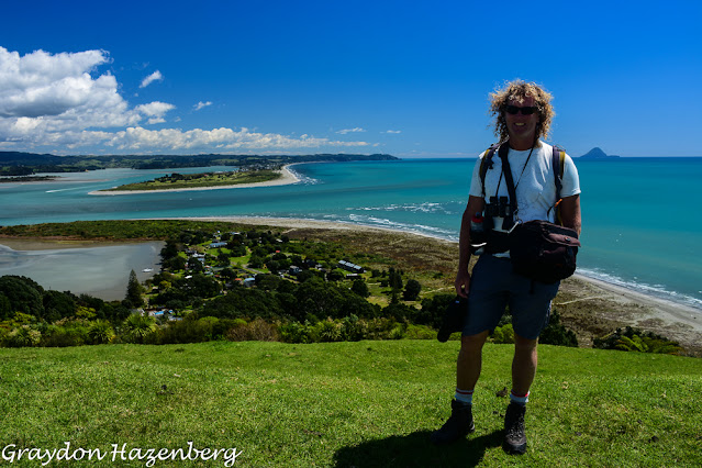
Showing posts with label new zealand. Show all posts

Thursday, February 10, 2022

Ambling Through New Zealand's North Island (September-November 2021)


A coastal hike near Opotiki

Greymouth, New Zealand

It’s a prodigiously rainy and windy day, as a huge rainstorm batters the west coast of New Zealand’s South Island. Terri and I are huddling indoors at a welcome refuge at Duke's Hostel, a venerable backpacker's joint in Greymouth.  It’s a good day to write a blog post, and a good day to be under a solid roof.

One of the maps that Terri created for my new book during MIQ

It’s time to catch up on our travels. When last I wrote, I reported on our fun three-week jaunt through Turkey back in August, 2021. We then flew to Auckland, via lots of covid-related restrictions and hoops; there was an anxious ten-minute wait in Istanbul airport while Singapore Airlines check-in staff had a telephone conversation with New Zealand Immigration to make sure that I was eligible to fly into the country. We arrived late on the evening of September 4th into a ghostly, almost-deserted airport, got processed and sorted onto our bus, and taken to the Rydges Hotel, our home for the next two weeks of Managed Isolation and Quarantine (MIQ).
Some of Terri's grandkids

Those two weeks passed surprisingly pleasantly. We had a room on the eighth floor, with a view towards Auckland’s Sky Tower, two enormous king-sized beds and three delicious meals a day delivered to the room. We were confined indoors except for occasional “exercise” sessions on a rooftop terrace or along the ramp leading to the underground parking garage; we weren’t allowed to do anything that might result in us breathing heavily, so the word “exercise” didn’t seem to have its usual meaning. The weather was relentlessly cold and rainy, so we weren’t itching to be outdoors, and we amused ourselves by watching US Open tennis, reading and (in the case of Terri) working on the hand-drawn maps for my next book, about my Silk Road cycling ride.

After two weeks, we were certified as disease-free and ready to be released into the community. While we were in Turkey, New Zealand had had its first serious covid outbreak in over a year, and so Auckland, the epicentre, was under a partial lockdown. As a result the North Island was cut in two, and travel from north to south through Auckland was impossible. We had planned to wait out the chilly months of September and October somewhere in the north, but instead we picked up Edmund the Elgrand (our third camping vehicle, after our beloved Stanley and much-used Douglas) at Terri’s daughter’s farm on the northern outskirts of Auckland, spent a hurried couple of hours visiting, and then fled south to the liberty of Hamilton. We spent a week there at the house of Terri’s good friends Ross and Debbie, taking care of administrative steps like getting the van’s Warrant of Fitness renewed, getting our first shots of the Pfizer vaccine (we had not been eligible for vaccinations in Indonesia), buying me a second-hand bicycle, and obtaining a solar panel and second-hand storage battery to run our fridge/freezer.

Indiana with the first physical copy of my book that I'd held 

Another delicious dinner with Lilian and John


Terri with her cousin Phillipa and her family

We might have lingered longer in Hamilton, but covid began to leak out of the Auckland cordon into the Hamilton area, so we fled further to the Tauranga area where we holed up for almost two weeks with Lilian and John, inveterate globetrotting friends who had visited us in Tbilisi. They had a guest apartment where we hid out from more cold and rain, explored the fabulous variety of fruit trees that filled their property (we left laden with avocadoes and lemons) and worked on fitting out Edmund for the road. We bought a roof rack and a luggage box to go on it, had the 175-watt solar panel attached onto the rack, mounted an awning and tent to hang off the side of the vehicle, and I even put my physics degree to practical use as I wired up the battery, the solar controller unit, the solar panel and the interior electrical outlets. (My initial wiring wasn’t really up to snuff, and I ended up having to redo it a couple of weeks later, but since then it’s functioned perfectly, which pleases me immensely.) We also rode our bicycles around, hiked up Mount Maunganui, did pullup bar workouts in playgrounds (keeping up the routines we had established in Bali) and had late-afternoon beers and dinners with Lilian and John, recounting stories from the road. (They are some of the few travellers I’ve met who have been to far more countries than I have, and their stories of travels in the 1970s were epic.) Importantly for further travel, we were also able to get vaccinated (something that we had not been able to do in Indonesia) with our first dose of Pfizer. We also dropped in on more of Terri's friends and family living in and around Tauranga.

Terri and her cousin Pepper

Eventually the van was ready to hit the road, and we started our stately progress down the east coast of the North Island. We started with a few nights in Ohope, just to the east of Papamoa. It was my first experience of “freedom camping”, in which towns designate certain areas for self-contained vehicles (ones with a toilet and a grey-water container) to stay for free. The Ohope freedom camps were nothing to write home about, with lots of vehicles crammed into small spaces, but it was a chance for us to test out our set-up. We discovered soon that my wiring job wasn’t up to snuff, as I hadn’t quite gotten the connectors from the solar panels to the roof to complete the circuit; we discovered this when the car battery stopped working and I started crawling around the circuit with a voltmeter. Once I had the panel working, we were back in business. We also discovered that rain is a constant accompaniment to camping in New Zealand!

Morgan, steak chef extraordinaire
From there we drove to Kutarere, a tiny community between Ohope and Opotiki. There we were lucky to stay with Terri’s cousin Pepper. We were very glad to have a solid roof over our heads when a torrential downpour hammered down for two days and flooded Opotoki’s rivers. Pepper was an amazing host and she and her friend Mason kept us well fed and entertained. We tried our hands at gathering oysters near Opotiki, and were successful enough to have two massive oyster feasts. We also received in the post a new solar controller (I had mangled the previous one in my electrical incompetence) and this time I was much more careful in connecting everything neatly, with a crimping tool and lots of tiny ferrules to keep the wire ends neat.) Finally everything was hunky dory on the roof, and the electrics have remained trouble free ever since. The new controller also has a Bluetooth connection to our telephones, so we can check the status of the battery, the solars and the load circuit in real time, which is an addictive thing!

Eventually we tore ourselves away, via a night at the oyster beds (which proved to be a very noisy place to camp!) and our second dose of covid vaccine in Opotiki. We also had an auto electrician install a circuit to allow us to charge our storage battery from the car engine when it’s running, something which has been an invaluable boost to the battery on days when the sun hasn’t shone enough.

An oyster feast


Majestic horse near East Cape

From Opotiki we started driving towards the East Cape, the big and somewhat remote protrusion in the northeast corner of the North Island. We stopped in at Omaio, at a freedom camp that we had been told about, and stayed for almost a week. The campsite is a huge field up above the beach, and at times we had it almost entirely to ourselves. Even when there were a few other campers, we all had lots of space to ourselves. It was a lovely spot, with oysters to be had from the rocky shoreline and great cycling along the coastal highway. Terri was feeling a bit under the weather from her second vaccine shot, and this was a perfect spot to rest and recuperate. Most of our camping neighbours were keen fishermen, and we were given some delicious snapper as a welcome addition to our food supply. The energetic lady who ran the local shop kept us entertained with stories, and warned us that we were only welcome if we’d been vaccinated. She had been vaccinated, and was glad to report that although she’d been infested with nanobots and turned magnetic as a result, she’d used Epsom salts to wash them away. We nodded wisely and tried not to giggle.

From Omaio we made our way further out along the Cape to lovely Maraehako, a commercial campground with a lovely location in a secluded cove. We rented kayaks and explored the shoreline, deeply pitted with caves. That evening, as we were sitting in our tent, we heard the call of a little blue penguin and went to the shoreline to see one walking along the shore between brief swims in the sea. It was our first sighting of blue penguins this trip (although we’d seen them several times on our 2018 trip), and it was wonderful to see this endearing creature again in the flesh.

Edmund on the road back from East Cape

East Cape lighthouse

We made it to Te Araroa next, a small community just west of the East Cape. We drove out to the East Cape itself and climbed up the hill to the lighthouse that marks the easternmost point in mainland New Zealand, a beautiful if windswept spot. We liked it so much that the next day we jumped on our bicycles and rode most of the way back to East Cape, revelling in the fabulous coastal scenery, although we got caught in rain on the way back to Te Araroa. From there we drove inland to Te Puia Hot Springs (which were, sadly, closed) and then south to Tokomaru Bay, the first of a series of coastal towns that stretch north from Terri’s birthplace of Gisborne. We spent a couple of days in Tokomaru Bay eating delicious fish and chips, doing workouts at the local rugby field (the goalposts made a great bar to hang our gymnastic rings from) and lazing beside the shore. The beach was pretty, although it had a thick covering of driftwood resulting from the extensive logging operations on commercial timber plantations all along the East Cape.


Baby paradise shelducks at Cook's Cove

Male paradise shelduck looking protective of his brood


Lovely Tokomaru Bay

We moved on to Tolaga Bay, almost a twin of Tokomaru Bay, where we hiked out to Cook’s Cove (where James Cook anchored back in 1769), cycled, worked out and ate more fish and chips. It was an idyllic spot, but we could see bad weather appearing on our weather forecasts, so we fled to Gisborne to shelter under the roof of Terri’s childhood neighbour Helen. We ended up spending nearly a week there as the rain just continued to fall, breaking local precipitation records and flooding low-lying areas of Gisborne. It was a relief to be indoors, and we had a wonderful time catching up with Helen, her sister Vicky and their mother Bessie, who told us all sorts of stories from her childhood, her family history and the childhood of Vicky, Helen and Terri in the suburbs of Gisborne. Gisborne (which we had visited in 2018) reminds me a lot of my hometown of Thunder Bay. It has an industrial air to it, a commercial port, a feeling of isolation (a lot less in the case of Gisborne, but psychologically it feels remote from the rest of the North Island) and a sense that the economic and property boom engulfing the North Island is leaving Gisborne behind a bit.

Peaceful Mahia campsite


Cycling on the Mahia Peninsula
We almost didn’t leave Gisborne, not because we didn’t want to but because our van refused to start. We managed to get it going in the end and drove to the lovely Mahia Peninsula, where we camped on a fabulous beach after having to tow the van the final few hundred metres from the corner store where we had unwisely stopped the engine. The next day we finally got the car to start after many attempts, contacted a mechanic in nearby Wairoa and drove to camp nearby. We had a pretty place to stay, although the next morning we encountered one of the few instances of genuinely unfriendly behaviour of the trip from a local woman who let her dogs run free; when they tried to ransack our food supplies we asked her to control her dogs, whereupon she exploded in a foul-mouthed tirade. Still shaking our heads, we drove to Terry the mechanic’s place, had the problem diagnosed (our starter motor needed new carbon brushes) and camped in his backyard. The next day a courier delivered the necessary part, and by mid-afternoon we were driving away, back to the Mahia Peninsula to resume our interrupted idyll by the sea.


Neat rock patterns on the Mahia Peninsula
We spent a few days on the Mahia Peninsula, site of many happy childhood memories for Terri, whose father and mother used to bring the children there to the beach. It’s a spectacular spot, with a sheltered beach on one side and a wild coastline open to the ocean on the other side. We hiked, cycled, collected shellfish and chatted with our neighbours, an eclectic mix of travellers from all over the country. At the southern tip of the peninsula a company called Rocket Lab has a launch facility for commercial satellites; there was a launch scheduled while we were there, and lots of campers showed up to watch, but it was cancelled due to high winds so we weren’t able to see the spectacle.

Refreshed by the Mahia Peninsula, we drove south towards Napier, staying at a Department of Conservation (DOC) campsite at Lake Tutira. It was a beautiful spot, but we were raked by gale-force winds that stirred up the tiny lake’s surface into a roiling mass of whitecaps. We found a place to camp that was sheltered by a belt of tall trees, but in the middle of the night we were awoken by a thunderous crack that shook the car. I got up to find that a massive branch had broken off one of the trees, narrowly missing our neighbours who were sleeping in a small tent. As I got up, I saw them frantically packing up and throwing their gear into their car before driving off; had that branch fallen two metres to one side, they would have been crushed to death under it. It was a sobering night!

An angry and malevolent swan, Lake Tutira

In the morning we awoke to find the wind still strafing us, but we went for a lovely hike anyway high into the hills. It was a mixture of lovely native bush, mature pine plantations which creaked ominously in the gusts, and cutover slash piles from plantations that had been felled recently. Forestry is never a lovely sight to behold, but in New Zealand, where the native forests were often felled and burned a century and a half ago, these stands of alien-looking exotic trees planted in neat rows on land that was sheep paddocks not long ago, it’s particularly jarring.

Samson family reunion near Napier

Rock album cover shot


Cliffs along the way to Cape Kidnappers

Having survived Lake Tutira, we made our way to Napier via a few short walks in the hills, in tiny pockets of surviving native forest. At Haumoana freedom camp we rendezvoused with Terri’s sister Karen and her husband Joshua. We had a great get-together and a feast of grilled chicken before retiring early in anticipation of the next day. We awoke and made an earlier start than usual as our schedule was determined by the tide tables. We spent the day walking along the beach out to Cape Kidnappers, along the sand left behind by retreating tides, underneath impressive vertical cliffs. It took about three hours to get to our destination, a huge colony of Australasian gannets who nest atop the cliffs. We saw them a few years ago west of Auckland, but this was made more special by the effort required to get there. With a wary eye on the incoming tides, we retreated the way we had come, marching back past a smaller gannet colony as well as cormorants, gulls and terns. It was an exhilarating walk, and we got back to the start long before the tide cut the track. I went off for a short bike ride once we were back in camp, glad to get in lots of outdoor activity on the warmest, sunniest day we had experienced yet.

Yours truly on the way to Cape Kidnappers

A loud dispute in the gannet colony

A male gannet bringing a seaweed garland for his mate

Terri and a few of her gannet pals

The view from the top of Cape Kidnappers


The sheltering mossy forest on Holdsworth

From Haumoana, we drove south for several hours through agricultural land until we reached the foot of the Tararua Range and Mt. Holdsworth DOC campground. We set up our tent and awning and went for an exploratory ramble along the river. Back at the car we arranged accommodation for the following night in a DOC alpine hut up atop the mountains, grilled pork chops, packed our backpacks and got ready for our first overnight hike of the trip.

It dawned bright but windy the next day, and we sweated uphill through the dense forest, our bodies unused to our heavy backpacks. The higher we got, the more the wind howled, until by the treeline it was blowing a full gale, almost knocking us off our feet and turning our backpacks into sails. We persevered to Powell Hut, at about 1050 metres above sea level, where we sheltered indoors for several hours, unwilling to face the ferocious winds, lingering over lunch and endless cups of tea. Finally, around 2:30, it became less blustery and we were able to wander, carrying only a camera bag and some warm clothes, up towards the summit of Mt. Holdsworth. It felt like a homecoming to be up above the treeline in the tussock grass of the alpine zone, walking through a dramatic mountain landscape dissected by deep gorges. We made it to the top of Mt. Holdsworth and partway to the next peak, Jumbo, before turning back to trot downhill to the warmth of the hut. It was a full hut that evening, with a diverse group of trampers sharing stories and experiences. The Tararuas are not too far from Wellington, and a lot of the hikers came from there, either university students or government employees out for their first big hike of the year. It was a fun atmosphere, and Terri and I feasted on pasta carbonara padded out with a few rashers of bacon. The full moon rose as we headed to bed and lit up our hut room with its pale silvery glow.

Atop a breezy Mt. Holdsworth

Descending from Mt.Holdsworth


Castle Rock and its sketchy-looking summit walk

The sunrise the next morning was spectacular, setting the sky alight from first light. The winds had returned with a vengeance, and we were glad to get down into the shelter of the trees as rain clouds gathered overhead. We threw our packs into the car and drove to Castlepoint, a pretty seaside village that’s been gentrified with lots of expensive new baches (summer/weekend cottages). We hiked along the dramatic seashore and up to Castle Rock, a peak that seemed to loom perfectly vertically above the shoreline. The path proved to be less alarming than it looked from below, and the views were sensational. We descended carefully and set up camp in a little freedom camp on the edge of the dunes.

The vista from atop Castle Rock

A chilly Terri at Castle Point


Lazy sea lion near Cape Palliser

From Castlepoint we retreated to Masterton, the regional hub, sorted out Department of Conservation campsite passes (a steal at NZ $100 a year, given that one night in a campground costs $15 per person) and then headed south towards the southern tip of the North Island. It was a dramatic drive along a rugged, remote coastline to Cape Palliser and the 254 wooden steps leading up to its lighthouse, from where we hiked for an hour along the coast to an abandoned 19th century Maori village. We swam in the rather frigid river, returned to the car, visited a nearby colony of sea lions and then drove back a few kilometres to camp at a DOC campsite at the foot of the Putangirua Pinnacles.

Sea lion pup, Cape Palliser


Putangirua Pinnacles

We explored the Pinnacles on foot the next day. They are very picturesque eroded conglomerate, rather like the Badlands of South Dakota, or the houdous of the French Alps near Guillestre which we visited last year. It was a decent-sized hike, almost four hours, and got us salivating about the longer treks we were hoping to do in the South Island. Our campground neighbours gave us some paua (abalone) which they had gathered, which tasted absolutely delicious. The fresh seafood and fish from New Zealand’s oceans really are some of the culinary highlights of travel in this country!

Putangirua Pinnacles

Wildflower, Pinnacles Track

Lovely butterfly

The next day was devoted to trying to find one of New Zealand’s most elusive and cryptic native birds, the matata or fernbird. We drove to Boggy Pond, one of the few places where they are reliably seen. Although it was a lovely spot, full of black swans, paradise shelducks, cormorants and tiny baby pied stilts, we had no luck with the fernbirds. We retreated for the last time to Masterton to have lunch in a city park with Terri’s old army friend Vivienne, and then headed out to cycle part of the Remutaka Rail Trail. It was steep for a train line (this section had its own specialized hill-climbing engines in the 19th century) but made for a spectacular ride. It felt good to be cycling in nature rather than along the side of a highway for once! 

A baby pied stilt


Tuatara, Zealandia

We coasted downhill from the summit tunnel and then rashly followed Google Maps’ directions towards a freedom camp. The program saved a few hundred metres of distance by sending us along a dirt road with a small ford in it. We discovered that Edmund the Elgrand doesn’t really like fords when we lodged it firmly in the pebbly riverbed, partially tearing off the rear bumper in the process. We took off the bicycles from their bike rack at the back and Terri managed to coax the vehicle up the opposite bank. After all that, we didn’t even end up staying at the freedom camp since it was apparently abandoned and lived in by a collection of people who seemed to have substance abuse and anger management issues. Instead we drove to an idyllic DOC camp a few kilometres away and spent a peaceful night.


Red-fronted parakeet (kakariki), Zealandia
The next day was our last day of real exploration on the North Island. We tried to hike along a path marked on our map app, but the trail soon petered out, apparently abandoned and overgrown. Instead we drove to the other side of the Remutaka Rail Trail, pulled out the bicycles and pedalled up the other side of the previous day’s incline. The grade was far gentler on this side (1% rather than 5%) and almost imperceptible at times. The scenery was magnificent, and it was a fun morning’s activity. On our way towards Karen’s house at the Kapiti Coast, we stopped off at another birdwatching spot, Pauatahanui, again looking for matatas, and again striking out, although three biology students we met had seen one just ten minutes earlier. We admitted defeat eventually and drove on to Karen and Joshua’s house, where we spent our last days on the North Island eating, drinking and making merry. We did sally forth one sunny day to explore Zealandia, the amazing predator-free bird sanctuary in the very heart of Wellington (we had been there in 2018 as well), but aside from that, we stayed close to home. Joshua fixed up our mangled bumper, and we visited a couple of Terri’s nieces and nephews who live nearby. Once again we were lucky to enjoy such warm hospitality, always a wonderful feeling after weeks of living out of our campervan.

In the early hours of November 30th we embarked on a ferry to take us across the Cook Strait to the South Island, but that story will have to wait for the next blog post. We spent a total of almost three months on the North Island, moving at a very leisurely pace and waiting (mostly in vain) for the cold, blustery spring weather to change into warm summer. It was pleasant, but we were both keen to get to the big wide-open spaces of the South Island and some larger-scale outdoor adventures.


Majestic kaka, Zealandia


Wednesday, April 18, 2018

West Coast Finale, March-April 2018

Lipah, April 18th

For a Google map of this part of our trip, please click here.

Our very muddy launch onto the Whanganui 
The final leg of our trip around New Zealand's North Island began on March 15 when we drove north out of Upper Hutt, headed up the west coast.  Our first destination was Raetihi, a small tourist town north of Wanganui, a town where my sister Audie had once spent a year on a high school exchange. That first day we drove up the main highway to Wanganui, then turned up the scenic River Road to get to Pipiriki, followed by a stiff climb to Raetihi, up on the central volcanic plateau.  We stayed in a friendly AirBnB that night and had a look at weather forecasts.

Whanganui River
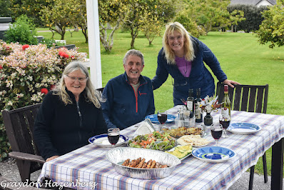
The plan was to spend three days paddling down the Whanganui River in canoes, but Mother Nature wasn't playing along.  March 16 was a complete washout, with rain all day.  We spent the day indoors reading and repacking gear for the river trip, then slept a second night at the AirBnB.  We had debated whether the $180 per person for canoe hire and transport was worth it, but in the end we were glad that we shelled out the cash for a fabulous experience.

March 17 dawned crisp and clear and we drove over to the canoe rental spot to park our car and be shuttled to our put-in point at Whangahoro.  There were two parties in the truck that morning:  ourselves and a Spanish-Belgian couple, Pieter and Veronica.  The boss of the rental agency, Trev, was a fount of local information, and told us that we were the first wave of canoeists to put in at Whangahoro since disastrous flash floods ten days before, during which the river level had risen 12 metres overnight.  The road leading to Whangahoro had been closed for repairs ever since, and had just reopened the previous day.  The launching site was under a thick, gooey layer of mud, and the river's course had shifted, resulting in an unexpectedly tough rapid about 10 metres after putting in.  Terri and I capsized here, hardly an auspicious start to the trip!

The Bridge to Nowhere
From that point on the river was much more placid in terms of rapids.  What it lacked in adrenaline, though, it made up for in scenery.  The Whanganui River is deeply incised into soft mudstone, resulting in sheer-sided cliffs.  This stretch of the river has no road access, and the early settlers in the area depended on river steamers to transport their sheep and wool to market.  It was a perilous existence in an unforgiving environment, and over the 25 years between the end of World War One and 1943 almost all of the farmers (who were allotted the land as returned veterans of WWI) ended up abandoning the struggle; the last three families were evicted by the government in 1943.  This has left a large swathe of land to return to native bush and provided a large nature reserve for tourists to paddle through.  We drifted and paddled along for much of the day, oohing and aahing over the landscape, before making camp at John Coull's campsite.  Despite being one of the last canoes to arrive (about 20 canoes from 6 different outfitters spent the night there), we got the best campsite.  We fried up delicious steaks, had a bottle of fine red wine and watched the rare native New Zealand bats (both the long-tailed and short-tailed) flying insect-catching sorties in the gloaming.  It was a perfect evening.
Layers of history that we were paddling through

Paddling bliss
The second day was more of the same, except even more fun.  It was another day of placid rapids and sheer cliffs, but enlivened by a midday walking excursion to see the Bridge To Nowhere, built to extend road access to the isolated farms in the late 1920s, but which was insufficient to save these economically unfeasible endeavours.  The road was abandoned because of persistent landslides--hardly surprising given the terrain and weather!--and now the bridge stands as a memory of a white elephant.  It's used now as part of a hiking and mountain biking track from Whakahoro to the Bridge To Nowhere river landing; this stretch is part of both the Te Araroa and New Zealand Cycle Trail routes that stretch the length of New Zealand.  Hikers and cyclists are usually picked up by jetboats that take them to Pipiriki, although they can also arrange to rent canoes to avoid using internal combustion engines.  Refreshed by this break, we rejoined the canoes and paddled to our campground at Tieke Kainga.  It was an idyllic setting and was also an active Maori marae, so we had a welcoming ceremony that risked being silly and touristy but instead was strangely moving.  There were only four canoes staying there that night (many others had camped across the river at another spot) and we sat around at supper (and at breakfast the next day) discussing travel, life, nature and possums.  The young son of the couple that run the marae went out with his father carrying a big stick to bash possums, but had no luck; a Spanish woman staying in our camp saw one later at night, but didn't have the heart to try to kill it, despite the fact that it is the most destructive predator on indigenous birds.
The steep cliffs enclosing the Whanganui River

A punga tree
Our last day of paddling, March 19th, was also the most action-packed in terms of rapids.  There were four rapids that we were warned gave us a reasonable chance of capsizing.  After a wonderful morning of paddling through the most vertical canyons yet, we fell in on the first major rapid, the aptly named Fifty-Fifty.  Luckily everything was in (mostly) waterproof barrels, as we were in the water for quite some time before being able to right ourselves.  This experience made us hyper-cautious on the next two, evading the main stream and its standing waves by slithering over rocky shallows.  We did manage to shoot the last rapid successfully, though, which gave us a sheen of respectability with the canoeists watching from the landing point just beyond.  Overall, the canoeing was a major highlight of our New Zealand adventures, especially as Terri had never done it before and we were both amazed at how utterly wild and remote it felt in the middle of the densely-settled North Island.

Headed up Tongariro


Our next port of call was the prosaically-named National Park, a small holiday town just west of Mt. Ruapehu and its ski fields.  Terri's friends Ross and Debbie have a small chalet there that they let us use, and we ended up sleeping there for three nights, glad to have a roof over our heads with cool nights and forecasts of more rain on its way.  The weather held good on the first day for our hike up Mt. Tongariro.  The Tongariro Crossing has become a mass tourism phenomenon, with thousands of hikers a day walking the trail, many inspired by the fact that parts of Lord of the Rings were filmed here.  We had heard of the crowds, the expense of catching shuttle buses and the restrictions on parking, so we decided to modify the classic route.  We parked at the Ketetahi trailhead at the north end of the crossing, the usual ending point, at 6:45 in the morning, and were amazed to find hundreds of cars already there.  Rather than following the hordes and catching a shuttle bus around to the other end of the trail, we set off to hike an out-and-back walk from where we were.
A New Zealand pipit

Steam rising from fumaroles at Te Maari, on Tongariro
The weather was perfect, with clear skies and cool temperatures, and we had the entire trail to ourselves.  We didn't meet another soul for the first three and a half hours as we climbed up through dense bush, then low scrub, and finally, at the top, alpine terrain.  One benefit of this was a series of encounters with birds, both the inquisitive, trusting fantail and the rarer endemic New Zealand pipit, both of whom followed us for long periods across the slopes.  To our left the steam vents of Te Maari puffed steadily; in 2012 they erupted and fired volcanic boulders onto the Ketetahi hut; we could see the damage, preserved for scientific purposes, in the structure as we walked past it.  Once we had crested the initial relentless climb, we peered out across a volcanic desert towards the craters near the summit of Tongariro, and to the symmetrical steep cone of Ngarahoe behind it.
Mount Ngarahoe, with a line of hikers crossing below it
We started to meet our first early-bird walkers as we crossed the plain towards the Emerald Lakes, and there we ran into Pieter and Veronica from our canoe trip, heading in the opposite direction.  We had one final steep grunt up a loose scree incline to the highest point of the Tongariro Crossing, where we stopped to admire the spectacular views up to Ngarahoe, down to the Emerald Lakes and across to the dramatic vents of the Red Crater of Tongariro.  It was a wonderful payoff for four hours of brisk hiking to stand in the middle of such natural dramatic beauty.

At the high point of the Tongariro Crossing
The return journey to the car began with a descent of the scree.  I love scree running, as it's a lot like skiing powder.  The pebbles of volcanic debris slide and roll under your feet, making it easier to slide and run than to walk slowly.  We both raced past long lines of slow-moving hikers, some paralyzed by fear at the unsteady footing; one unfortunate Korean woman was wailing uncontrollably as her boyfriend tried to talk her down.  At the bottom of the scree we stopped to devour a cold roast chicken that was the perfect picnic lunch, seating ourselves on the shore of one of the Emerald Lakes.  From there we joined the long lines of walkers stretched across the landscape, marching down to our little Mazda Demio eight and a half hours after setting out.
The tourist hordes descending the scree agonizingly slowly
We drove back to National Park a bit tired and a bit footsore, but elated at having seen such an iconic landscape and at having (half-) escaped the crowds.  In high season, it's said that over 3000 hikers a day undertake the Crossing, and it seemed like an underestimate that day.  I fear that with the growth of tourism and the global middle class, areas of famed natural beauty like the Tongariro Crossing will drown in the vast crowds that they draw.  Venice, the Grand Canyon, Yosemite, Banff and Mount Fuji show the future awaiting many of the grand vistas of our planet.

Emerald Lakes, Tongariro

Terri and her first house, Taupo
We had planned to hike to the summit of Mt. Ruapehu the next morning from the top of the ski lifts at Whakapapa, but we awoke on March 21st to rain and low clouds, so that plan had to be scrapped.  Instead we drove to Taupo to see some of Terri's past life.  Our first port of call was the National Trout Centre, but we weren't there for the fish.  Instead, we had read that the Centre was helping in the conservation of the endangered endemic whio, or blue duck, and we wanted to see.  Whio are bred in captivity in several locations around New Zealand, but the chicks all end up at the Trout Centre for some survival training before they are released into the wild.  We were lucky; that was the last day that the chicks were in residence, and we watched them being captured by the staff to be shipped off to various rivers around the country.  We had looked in vain for whio during our canoe trip, so we were happy to see the 8 residents of the training program.  When we went for a short stroll along the river next to the Trout Centre, we were pleasantly surprised to see a wild whio swim by.  It was heartening to see this iconic species being preserved with the help of so many conservation-minded New Zealanders.

The town of Taupo is on the shores of the lake of the same name, and has become the epicentre of campervan tourism in the North Island.  The town is pleasant but not spectacular, and the crowds at sights such as Huka Falls left me unimpressed.  I did enjoy seeing the first house that Terri ever owned, along with the various houses (and a motel) that Terri's parents owned over the years.  I even saw the site of Terri's youthful thrill-seeking in swimming holes below a dam that would release water every afternoon with Terri and her friends in the pools.  There's a prominent "No Swimming" sign there now, probably as a result of her reckless exploits years ago.

A whio, or blue duck, on the Whakapapa River
March 22nd found us cleaning up the ski chalet and driving north to our next adventure, the Timber Trail, a mountain bike trail that we had heard a lot about.  We took a room in an AirBnB in the town of Manunui run by a Czech ski instructor and her Kiwi partner, a professional pianist, both of whom made for interesting conversations.  We spent the afternoon on a hike through the Owhango Reserve, a small patch of native bush beside the Whakepapa River.  The hiking was enjoyable, but the best part was seeing no fewer than 12 whio bobbing in the river, an encouraging sign for an endangered species with only a few thousand surviving individuals.  There were also other endemic species like the tomtit and the North Island robin present too, all testament to the efforts put in to rid the reserve of possums, stoats and rats; we saw many traps and poison bait stations beside the trail as part of this endeavour.

Riding the Timber Trail
Our ride along the Timber Trail was a lot of fun the next day.  We rented bikes from a South African family whose son drove us to the midpoint of the trail at Piropiro, telling us entertaining tall tales the whole way.  We had 45 km to cover to get back to the car, and it was slow going, with lots of climbing, mud puddles and narrow tracks to contend with.  Most of the trail ran along the route of a narrow-gauge railway built to carry logs out of the forest.  The bush has had numerous decades to regrow, and is now a dense tangle of native trees and plants.  It felt wonderful to be back in the saddle exploring a beautiful corner of the world, and I felt the call of the cycle touring world again; Terri and I hadn't toured in over two years, since our trip through Paraguay in January, 2016.  We got back to the car, muddy and elated, mid-afternoon and headed back to the AirBnB to recover.

March 24th found us driving east along the Forgotten World highway, a road connecting remote farms that history has more or less left behind, between Taumaranui and the Taranaki region.  These farms are near the farms abandoned along the Whanganui River, but were not quite as remote or as rugged and managed to survive as going concerns.  We drove along beautiful stretches of river (including the upper Whanganui), over steep "saddles", or passes, and through the quirky town of Whangamomona, a self-declared independent "republic".
Crossing one of the big suspension bridges on the Timber Trail
We stopped for a bite to eat at the Whangamomona Hotel and behind the gimmicky nature of the "republic", the deep roots of local history shown in serried ranks of photos on the wall of the pub bore testament to the spirit and determination of generations of settlers, loggers and farmers in this remote pocket of the country.  We made it to the other end of the Forgotten World and entered the prosperous farming territory on the slopes of the conical bulk of Mount Taranaki.  A lovely beach house renting out rooms on AirBnB was our home for the next two nights, and we walked along the wild black sand beaches of Oakura before returning home to eat and catch up with the American horse enthusiast running the place.

In the woods of Taranaki


My alien radio antenna, New Plymouth
I really liked the Taranaki region, perhaps more than any other corner of the North Island except for Northland.  We spent the next day poking about the regional centre, the city of New Plymouth, and I found it an appealing place, with an artsy feel to the downtown core and a well-engineered Coastal Walkway leading out of downtown along the ocean shore that provided a focus for strolling, running and cycling, while surfers and fishermen cavorted below us.  We stopped in at the local museum for a stunning display on life in the long-ago Permian period, and on local Maori history.  Around the corner from there, the Len Lye Museum highlighted the "kinetic sculpture" of a New Zealand-born artist of whom I had never heard, but who impressed me.  The focal point of downtown New Plymouth was another Len Lye design, the Wind Wand, a 48-metre-tall kinetic sculpture that flexes and rotates with the breeze.


Enjoying our Taranaki hike

Hiking Mt. Taranaki
Mount Taranaki provided our next outdoor pursuit, an overnight hike to a Department of Conservation hut.  We drove our car up to Dawson Falls Visitor Centre the next day, parked and took to our heels, carrying our packs full of wine and steak and other goodies.  We walked partway up the summit trail, having toyed with the idea of staying at the high Syme Hut for a summit attempt the next day, but swirling clouds and the number of people heading up ahead of us made us reconsider.  Instead we traversed the tussock grass for a while, getting sweeping views of the surrounding countryside and occasional glimpses of the summit, then dropped steadily downhill into dense native bush to Lake Dive Hut.  We had the entire hut to ourselves, although we had met a big school group who had told us they were planning to sleep at the hut too.  The views were magnificent, and we heard the distinctive call of a New Zealand falcon close to the hut, although we were unable to spot it.  It was an idyllic spot to spend the night, just Terri and I and the surrounding wilderness.
On the slopes of Mt. Taranaki

Terri moving through the tussocks on Taranaki
We took another, lower trail to return to Dawson Falls the next day and it was challenging, between the constant ups and downs across deep ravines, the washed-out sections of trail, the fallen trees and the general lack of maintenance of the path.  It was probably more tiring than the previous day's climb and descent, but also enjoyable for the isolation and for the flora of the forest.  When we got back to the car, we cooked up a big brunch of bacon and eggs before heading back to Oakura, this time to visit a Kiwi friend from our Leysin days who had returned to New Zealand to live.  She and her parents lived in a spectacular location atop the cliffs of Oakura, and I fell in love with the spot.  It was great to talk to her and to her mother and father about the area, about travel and living off the grid and fishing.  We had a fabulous dinner and slept well, despite heavy rain overnight.
Terri and the Marshalls, father and daughter

A flower on Taranaki
We paid the price for a late, lazy departure the next day when we arrived at our next destination, a funky off-the-grid hippy commune AirBnB named Hakea, in pitch blackness.  It was a deceptively long drive through miserable weather, but it proved to be worth it.  Hakea was a pretty place, inhabited by an interesting family, and provided lovely walks (between the rain showers) and a chance to read the best travel book I had read in a long time, Colin Thubron's magisterial To A Mountain In Tibet, which I devoured in a day.  We spent two nights there, resting and eating and relaxing.
Morning view of Taranaki's summit

Proud property owner:  Terri and her former house in Hamilton
Our next, and in some sense final, destination was the city of Hamilton, where Terri had lived during her university years.  We stayed with Ross and Debbie, this time in person at their house there, and spent a couple of days catching up with them, having last seen them in Bali last September.  The first afternoon we were there we explored more of Terri's past by visiting the campus of Waikato University and the house she used to own close by, then went to the stunning Hamilton Gardens with Ross and Debbie.  The gardens, subdivided into a dozen or more themed gardens, were wonderful, even with the hordes of Easter Weekend tourists overrunning the place.

Ross, Terri and Debbie
We started the next day with a hike/run up the Hakarimata hills outside Hamilton, and it was a challenging hill to try to run; I had to stop for breath about two thirds of the way up.  There were great views from the top as far as Ruapehu and Ngarahoe, and a fun atmosphere of dozens of other fitness enthusiasts running or powerwalking their way to the top.  After a lazy afternoon, we had a big barbecue with Ross and Debbie along with their daughter and her boyfriend.

With only two full days left until my flight out, we were almost out of time.  April 1st was spent driving back to Mt. Maunganui to pick up Terri's bicycle from storage at Jo Veale's place, with a pleasant hike around Lake Maclaren on the way home.  April 2nd we said goodbye to Ross and Debbie and drove north to Clevedon, where we visited Terri's friends Angela and Adam, three of their four young boys and their collection of vintage Land Rovers.  In their pre-child days, Angela and Adam had driven from the UK to Singapore, and we heard a few tales from the road and told a few of our own from Stanley's Travels.  That afternoon we met up with Terri's cousin Stewart and his wife Nicky for a brief hike in the Hunua Ranges, hearing about Stewart's participation in the Tour Aotearoa a few weeks before.  Then it was time to drive to Papakura and the only really dismal accommodation of the entire trip, a rather ratty AirBnB room.  The next morning, after a few brief errands, Terri dropped me off at Auckland Airport for my flight back to Bali.
Terri with Angela, Adam and three of their sons

Nicky, Stewart and Terri
Overall, I really enjoyed exploring the North Island in depth.  We managed to do quite a bit of hiking, with some paddling and cycling thrown in for good measure.  We saw lots of endemic bird species, plenty of stunning beaches and dramatic mountains, and plenty of native New Zealand bush.  We enjoyed lots of warm hospitality from Terri's friends and relatives (and my friend Eileen), and got a chance to get a feeling for New Zealand from the hours of conversation we had with people.  New Zealand is certainly a lot pricier than it was when I visited back in 1992 with my friend Hans, largely a result of the incredibly expensive real estate market.  Even staying as often as we did with friends and relations, we still spent a sobering amount of money, but we did have fun.  If I went back to the North Island, I would want to be on a bicycle, or hiking the Te Araroa, or maybe on a sailboat, as I feel that we saw almost everything we would want to see travelling as we did in a rental car.  Realistically, though, if we went back to New Zealand, it would be to see the wilds of the South Island next time.  Farewell, North Island, it was fun!