Livingstone, Zambia, September 1st
 |
| Terri and Stanley at Nsobe |
Of all the countries we have
visited so far on our southern Africa loop, Zambia is the one that most feels
as though we have left the shadow of the developed world for the bright
sunshine of “real Africa”, whatever that means.
And in Zambia, it is the area northeast of Lusaka that best exemplifies
that feeling of falling off the map. It
was for exploring precisely this sort of area that we bought Stanley in the
first place, allowing us as much freedom as possible in terms of travel and
independence. Our swing through that
area was one of the biggest highlights so far of Stanley’s Travels, and
reliving this trip while writing this blog post has reminded me of how
wonderful some of these places are; perhaps it will inspire some of you, gentle
readers, to explore northern Zambia on your own.
 |
| Shoebill |
The Road to Muyombe: Paved
with Good Intentions?
We entered Zambia on Tuesday,
July 26th, fresh from our fabulous sojourn on the picturesque Nyika
Plateau. The road to the border on the
Malawian side had been miserably corrugated and potholed gravel, deteriorating
sharply in quality as we approached the curiously one-sided border post where
the Malawians had a presence (albeit a young woman who was filling in for the
real border official, and who had to phone for assistance in how to stamp
foreigners out of the country), but the Zambians had nobody. We drove into the country along a track that
left us puzzled by its frequent unsigned bifurcations; we ended up stopping and
searching for locals to ask “Is this the road to Isoka?”. We were frequently skeptical of the answers,
as the jeep tracks closely resembled footpaths, but local knowledge proved to
be accurate as we made our way downhill towards the town of Isoka, some 240 km
from the border.
 |
| The M14 superhighway |
We had no real intelligence about
the quality of the track, although we suspected that it would be poor. This, to put it mildly, was an
understatement. This “road”, graced with
the title of the M14, is little more than a cartographer’s cruel practical
joke. It may well be the worst road I
have ever driven a vehicle on (although I have cycled on tracks of equal misery
in places like Pakistan, Tibet, China and Chile). Since almost no motorized traffic comes this
way, the paths are mostly made by pedestrians and cyclists, who need only have
one narrow path for their wheels or feet, rather than the twin paths needed for
a car. The result, given the tremendous
erosion and utter lack of maintenance, is a series of deep gullies separated by
one, two or even three narrow tracks of compacted red laterite earth that may or
may not be the right spacing apart for a vehicle’s wheels. We crawled along at walking pace, Terri at
the wheel, frequently stopping to get out and inspect a particularly hideous
stretch of track, cursing the road and the engineers who didn’t maintain it and
the mapmakers who pretended that it was a driveable path. It took absolutely forever to make our way 50
km down the road to the tiny village of Muyombe, one of the few actual
settlements along the road. There were
not many villages at all, and those that existed were about as poor as any
place we have seen so far on this trip.
 |
| Lungu election T-shirts and maize flour--the Muyombe road |
We knew that we were approaching
a centre of some slightly augmented significance when we spotted the cyclists
sporting new Edgar Lungu election T-shirts and carrying bags of famine-relief
corn flour on their luggage racks. Terri
and I were just discussing where we would ask for permission to camp (at a
village school? A chief’s house?) when,
completely unexpectedly, we came across a sign to a new lodge on the outskirts
of Muyombe, Mama Wuyoyo’s. We followed
the sign and soon found ourselves in a newly-constructed compound run by
Collins, an articulate Livingstonian who had moved to the sticks a few months
before to help start a new hotel built by a local woman made good who wanted to
share some of her good fortune with the village she had left behind years
before. The lodge was actually full of
district medical staff doing a one-week course, and Collins said that it was
the first time in three months that they had had more than a tiny number of
guests. We camped in the garden and had
a sundown Mosi Lager before having a meal of extremely muscular chicken in the
lodge restaurant and collapsing into bed, utterly spent by the rigours of
driving 128 kilometres.
 |
| Collins and Terri at Mama Wuyoyo's Lodge, Muyombe |
We had heard (or perhaps we had
hoped we had heard) that the next day we would hit asphalt after 60 kilometres. Terri was at the wheel again, as she usually
is when the road gets tough, and was bound and determined that she was going to
drive us as far as the tarmac before handing over the wheel. We ground on, past hundreds of people in President
Lungu campaign T-shirts and passing several fancy 4WD vehicles speeding the
other way. We finally asked the driver
of a passing campaign truck that was grinding its way painfully along the track
what was going on. “President Lungu is
coming to Muyombe for a campaign rally today!” we learned. We asked whether he was driving along the
appalling joke of a track, and were not surprised to hear that he was flying into
Muyombe in a government helicopter; only his minions had to endure the perils
and potholes of the road. Maybe if he
had to drive like everyone else, the road would get repaired sooner?
Sixty kilometres of bad road came
and went and there were no signs of asphalt, so after 75 kilometres, I finally
convinced Terri to stop, have a sandwich beside the road and change
drivers. There were signs of a new road
that had been started a couple of years earlier but then abandoned when the
government ran out of money for the project.
We would drive along a few kilometres of smoothish gravel, laid atop a
properly drained roadbed with concrete culverts, only for it to come to a
crashing halt and leave us back on the horror of the old M14. Eventually, almost 110 kilometres from Muyombe,
we hit asphalt and raced the following 80 kilometres along completely smooth,
utterly empty highway at 90 km/h. Just
to remind us of how bad it could be, the final two kilometres leading to the
main T2 highway were unpaved again, full of rocks and deep gullies and general
unpleasantness. Once on the road, we had
to figure out where downtown Isoka was (it turned out to be about 8 km north of
the main road) and search for the immigration office. Immigration was housed in a tiny, unmarked
office that was unmanned, but the police gave us the number of the immigration
officer so that we could set up a passport-stamping appointment for the
following morning. Downtown Isoka
offered little more than diesel and a disappointing little not-so-supermarket,
so we retreated out of town to camp at a little campground just north along the
main road. We negotiated the price down
to 70 kwacha (US$7) for the two of us, cooked up some supper and turned in to
sleep quite early. Just as we were about
to go to bed, President Lungu’s election truck, the one we had met along the
track in the morning, arrived at the campground. It turned out that Lungu was going to attend
a rally the following morning in Isoka.
We managed to get in and out of
the Isoka immigration office the next morning quickly, before the Lungu
roadshow closed the downtown area, but getting our car formally admitted to the
country proved to be impossible. The
police told us that there was no customs office in Isoka, but that we could
either process the car in Nakonde (100 km northeast, on the Tanzanian border,
in the direction opposite to our route) or else in Chinsali, 100 km
southwest. We got a letter from the
police saying that we had tried and failed to obtain the CIP (Customs Import
Permit) in Isoka, just in case we were asked for the CIP at a police roadblock,
then set off just as the police started closing roads in the downtown
core.
We roared down the highway,
covering as many kilometres in an hour as it had taken almost an entire day two
days previously, revelling in the ease of driving. After 100 km we turned off into Chinsali and
passed a series of new government buildings under construction. It looked promising in terms of finding a
good supermarket, refilling our LPG cooking gas cylinders and obtaining our
CIP. The promise was not fulfilled;
Chinsali was one of the poorest, least well-supplied cities of our trip; we
looked around hardware stores for something as simple as a washer (to help hold
our battery in place) and failed utterly.
Chinsali was so poor that we didn’t spot a single Indian-owned shop, a
single real supermarket or even a shop that sold beer. LPG was out of the question, and the customs
officials told us that they couldn’t help us get us a CIP, but that in Kapiri
Mposhi (some 400 km towards Lusaka) we could certainly obtain one. We got another letter for any police
roadblocks, then gave up on Chinsali and drove south towards Shiwa Ngandu, our
first sight to see. As we headed out of
town, we ran into President Lungu’s election caravan for the third time in two days,
with huge crowds lining the road to cheer the big man.
Shiwa Ngandu and Kapishya Hot Springs: Bathed in Loveliness
 |
| Stanley at Shiwa Ngandu |
It took us another 140 km of
great pavement to reach the turnoff for Shiwa, and then another 13 km of
reasonable gravel to reach the utterly unexpected sight of an English country
manor house transplanted to the wilds of northern Zambia. It was the life’s work of a remarkable man,
Stewart Gore-Brown, a classic upper-class Brit with a taste for remote places,
very similar to Wilfred Thesiger. He
arrived at Shiwa Ngandu in the 1920s and tried to make a go of a commercial
farm there. It never really paid for
itself, but Gore-Brown ended up falling in love with Zambia and feeling very
attached to its people. He ended up as
one of the leading politicians in pre-independence Northern Rhodesia and
favoured black rule, unlike many of his fellow white politicians. He ended up befriending Kenneth Kaunda, the
first post-independence president of Zambia, who said of Gore-Brown that “you
have a white skin, but a black heart.”
We drove into the estate, now run by Charlie Harvey, Gore-Brown’s
grandson, along a ceremonial driveway of towering eucalyptus trees, and
wandered around discreetly, peering over the fence at the main house, an
imposing brick baronial pile. There are
guided tours of the main house, but they are in the morning, so we were outside
visiting hours and contented ourselves with looking from afar. My friend and former colleague Nathalie, at
whose house we stayed in Lusaka, is related to the family by marriage
(Charlie’s wife is her aunt) and has visited several times. I read most of Black Heart, Joseph Rotberg’s
biography of Gore-Brown, during our stay in Lusaka in early July and was
motivated to get out to see the place.
 |
| Local children at Shiwa Ngandu |
We bought some fresh beef and
some impala from the farm shop, then drove another 20 rutted kilometres to
Kapishya Hot Springs, our home for the next three nights. On the way we ran into yet another Lungu
rally (although the president himself wasn’t at it), and finally managed to
score a pair of election T-shirts for ourselves. Kapishya was part of the original Gore-Brown
estate and is now run by Charlie Harvey’s brother Mark, a well-known figure in
Zambian wildlife tourism. We fell in
love with the place almost immediately because of its riverside campsite, its
feeling of remoteness, its birdlife and (most importantly) the hot springs
themselves. I have visited many, many
hot springs, both in Japan and in a dozen or more countries around the world,
and these are the first ones outside Japan that have rivalled Japanese onsens
for class, cleanliness, setting and beauty.
A big outdoor pool with a sandy bottom has been dammed in a small
stream, with hot water bubbling up from below into the pool. Terri and I spent hours lounging in the
springs in the mornings, late afternoon and evening. It was a great spot for
birdwatching, with lots of birds swooping across the opening in the trees above
the hot pool, and for stargazing after dark.
It was hard to put our finger on
what felt so good about lounging around in Kapishya. Part of it was the old-world charm of the
gardens of the lodge (next door to the campsite). Part of it was the feeling of great
remoteness, of being well and truly out in the wilderness. Part of it was the people whom we met, both
the other travellers and the staff at the lodge, including a couple of
volunteers who were working there for a few weeks or months. One of them, Zega, a 23-year-old Belgian, was
a Zambia connoisseur, having explored almost every corner of the country over
the course of half a dozen family trips to Zambia. We also met a Kiwi couple with a South
African friend who had lots of tips for us for our future travels.
 |
| Ross' turaco, Kapishya |
We were almost out of LPG, so we
cooked almost exclusively on the open fire while we were at Kapishya. There were some efficient cooking stoves
designed by an NGO that made simmering a stew much easier than on an open
fire. We concocted an amazing impala
curry one night that was one of the best meals of our trip so far, and made
some great pancakes as well. Gazing out
over the river, watching birds soar overhead as food cooked on our fire, we
felt like we were right where we wanted to be, deep in the heart of
South-Central Africa. We didn’t see any
large game (there are probably too many villages in the area for there to be
too many animals close to Kapishya) but the birdlife was excellent. Our favourite of the birds we spotted was
Ross’ Turaco, a spectacularly-coloured bird that hangs out in the gardens of
the lodge, although the palm-nut vulture was another big, spectacular bird.
We went for runs both afternoons
that we were in Kapishya, out through the scattered miombo woodland that covers
so much of Zambia. We didn’t see any
wildlife, but it felt good to be out in the woods, and to see some of the
villages in the surroundings. Both
Kapishya and Shiwa Ngandu employ quite a few local people (particularly Shiwa)
and support local schools, but these villages are still pretty poor in material
terms, with some not-very-fruitful subsistence agriculture and large
families. I attracted lots of kids who
tried to run along with me, but luckily I was faster than them in the long run
and eventually left them behind.
Kasanka: In the Land of the
Sitatunga
 |
| Terri shopping in a roadside market |
All good things must come to an
end, and after our third night, on the morning of Sunday, July 31
st we
decided to push on towards our next destination, Kasanka National Park. We retraced our path back to the T2, where we
bought prodigious quantities of fruit and vegetables from roadside vendors for
about US$ 7, along with diesel, beer and a bottle of Teacher’s whisky. We then drove down towards Lusaka, past the
turnoff to Mutinondo Wilderness, a destination that sounds wonderful, but which
we decided to leave for our next visit to Zambia (sometime in the new
year). We made it to the junction of the
T2 with the big north-south highway (the D235), turned right and headed north a
further 55 km to the gate of Kasanka National Park, where we paid for our park
permits and headed into the park.
 |
| Puku, Kasanka |
Kasanka is a small park that was
once, like many Zambian national parks, essentially abandoned. In the early 1990s a private organization of
Zambian wildlife enthusiasts, the Kasanka
Trust, took over its management and has since completely rehabilitated it,
building up wildlife numbers and its accommodation facilities. We drove to the Lake Wasa Lodge, where we
paid for our camping (very steep at US$20 per person per night) and watched
some of the waterbirds that were gathered on the lake, including some new
species for us: the spur-winged goose,
the coppery-tailed coucal and the yellow-billed kite, all of them to feature
again and again over the next 6 days. We
drove past the Fibwe Hide, described in our guidebook as the best place to see
sitatunga antelope, but utterly bereft of them this time. The hide is high up a large mahogany tree,
necessitating a long climb up a rickety wooden ladder. Fibwe is really used in November and December
to observe the world’s largest bat migration when some 7 million large fruit
bats gather for 6 weeks of feeding and mating before dispersing to parts
unknown. This bat gathering is the
biggest attraction of Kasanka, and it is when visitor numbers are highest. When we were in the park, there were two
other groups of tourists other than us, so we essentially had the place to
ourselves.
 |
| Kasanka puku |
 |
| Stanley camped at Pontoon Camp, Kasanka |
We stayed at Pontoon Camp, the
best-known of the four campsites in the park, and it was a great place to
sleep, as it should have been given the price! As soon as we arrived, camp
attendants appeared to kindle two roaring fires (one for cooking, and one for
sitting around) while, across the water of a small pool, some sitatunga
antelope, one of the shyest ungulate species, emerged from the shelter of some
papyrus reeds to graze. In most places
sitatunga will flee at the first sight of people, but here at Pontoon Camp they
more or less ignore humans. They are
dark animals, richly flecked with white, with impressive spiral horns on the
males. Some puku, another antelope
species rather reminiscent of the impala (although stockier in build and with
heavier horns), also came by to graze along with a family of cute little
bushbuck, while waterbirds such as jacanas, egrets and yellow-billed ducks
completed the wildlife picture. We had a
spectacular sunset over the water, and I realized that Venus, Mercury and
Jupiter were all visible close to the horizon after sunset, while Mars and
Saturn were directly overhead. We have
been watching the intricate dance of the planets ever since, observing how
their relative positions shift, quite rapidly in the case of Venus and Mercury,
night after night. It was a warm,
pleasant evening and we sat outside after a three-course meal listening to cicadas,
monkeys settling in for the night, sitatunga calling to each other, hippos
grunting contentedly and, in the not-so-great distance, an elephant. It was one of our absolute favourite
wilderness campsites, and felt very primeval and far from modern city life.
 |
| Sitatunga doe, Kasanka |
The next day we got up at 6:15
and had a quick cold breakfast while taking photos of sitatunga in the morning
mist. I really liked the white
highlights on their dark bodies: their
ears, tail and the tips of the males’ horns.
I also ran into a shy duiker who ran off as soon as he saw me. By 7:30 we had pulled Stanley’s roof down and
set off on a game drive. Kasanka is a
small park, but has quite a lot of variety of plant life, from dense miombo
grassland to seasonally flooded grassland plains (dambos, in the local
parlance) to dense papyrus thickets lining the rivers. We drove off towards a dambo, Chikufwe, where
we had been told a herd of sable antelope, a species I had not yet seen,
lived. We bumped along a pretty rough
track through the woods until we emerged onto a flat short-grass plain lined by
a profusion of short, thin termite mounds; apparently the termites build these
to have a dry place to retreat to in the floods that arrive with the November
rains. We saw lots of puku grazing contentedly,
but where were the sables? We got out of
the car and scanned the horizon carefully until Terri spotted them, a couple of
kilometres away on the other edge of the clearing. We counted at least 30 of them, but as we
drove around the edge of the dambo, they saw us and got spooked, running into
the woods and out of sight. Search as we
might, the dense bush hid them completely, and we eventually gave up the
search.
 |
| Sitatunga buck, Kasanka |
We drove off to Luwomba Lodge, in
the northwest of the park, hoping to do some canoeing. Both the canoes were out being used by the
Czech group who were staying next to us at Pontoon, so we sat and cooked up
some tea, eggs over easy and toast to go with the avocadoes and tomatoes we had
bought the day before, using up almost the very last dregs of our gas in doing
so. It was a pretty place to wait,
looking out over a sizeable river frequented by herons and kingfishers. By about 11 am, the Czechs were back and we
had scored the only real bargain of Kasanka, the use of a canoe for 3 hours for
a mere US$10. We paddled up the river,
deeply incised into the sandy plain, watching for kingfishers. We were not disappointed, spotting malachite,
pied, African pygmy and grey-headed, the last two new species for us. We also saw a profusion of Bohm’s bee-eaters,
a riot of primary colours in the trees.
It felt very wild, and we enjoyed the freedom of being away from the
sound of car engines, the only noise the sound of our paddles slicing into the
water. The light through the trees on
the water was beautiful, a dappled mix of sun and shadow, and we floated
contentedly back downstream, happy with our quiet commune with nature.
 |
| Terri canoeing in Kasanka National Park |
We drove back via Chikufwe again,
but this time the sables were nowhere to be seen. We headed to Kabwe, having heard that Cape
clawless otters were to be seen there, but when we got to the camp, the park
ranger said that we had been misinformed.
We drove back to Pontoon from there along a narrow strip of golden
grassland full of puku. We were back by
4 o’clock and Terri created a delicious lentil curry on the open fire while I
showered and sat watching the rich birdlife on the river and its banks: jacanas, glossy ibis, yellow-billed ducks,
blacksmith lapwings, pied kingfishers, red-necked spurfowl, reed cormorants and
African darters. The late afternoon
light was magical, as was the sunset over the reeds. We admired the planets again and then I sat
out learning how to enter GPS waypoints into our car navigation system and
playing guitar under a canopy of brilliant stars.
 |
| Water plants, Kasanka |
Tuesday, August 2nd
began with an early getaway, almost without breakfast, as we headed back to
Chikufwe for one more try at seeing the sable antelope up close. It was a futile effort, but we realized that
in the previous 18 hours since our last visit, a rampaging elephant had torn
down at least 10 large trees along the track, eventually forcing us to turn
back. Back at Wasa Lodge we talked to
Harry, a young Brit from Kasanka Trust who was glad to receive intelligence of
the whereabouts of an angry, injured elephant whose trunk was painfully caught
in a snare; that very day a vet was flying up from Lusaka to tend to it. We also learned that Shoebill Island Camp,
the place we had planned to stay at the Bangweulu Wetlands, was in the process
of closing down, but that we would be able to camp nearby at Nsobe. We drove back out to the asphalt of the D235
a bit unsure of what we would find out there at Bangweulu.
Bangweulu Wetlands: Livingstone’s Grave and the Land of the
Shoebill
 |
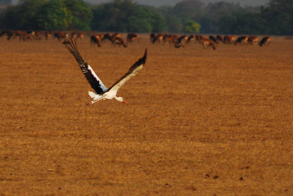
| White stork at Bangweulu. |
We drove 10 km north, then turned
right and onto a gravel road that led 25 km through densely spaced villages
full of begging children to the final resting place of David Livingstone. The great explorer had expired here in 1873,
18 months after his famous encounter with Henry Morton Stanley at Ujiji on Lake
Tanganyika. Livingstone was trying to
untangle the river systems of Central Africa and was trying to figure out
whether the Luapula River which flows through the wetlands flowed out into the
Zambezi, the Congo or even the Nile. He
died in this remote spot leaving the question unanswered, which was the reason
that Stanley came back to Africa to settle the mystery of the Luapula. It seems strange to me that as good a
geographer as Livingstone would have thought that there was any chance that the
Luapula flowed into the Nile, but Stanley solved the problem by following the
Luapula downstream for months and showing that it became the Congo River. His trip was desperately difficult and
dangerous, and it led indirectly to the establishment of the Congo Free State
and all the horrors that King Leopold inflicted on the region. I wonder how history would have been
different if Livingstone had survived long enough to do the Luapula trip
himself.
 |
| The forbidden fruit: Livingstone Memorial from afar |
After 25 uneventful kilometres we
arrived at the monument, a simple stone marker that shows where Livingstone’s
heart and internal organs were buried before his faithful followers Sussi and
Chuma pickled the rest of the body and carried it all the way back to the coast
at Bagamoyo. I was looking forward to a
bit of quiet communion with the spirit of the great man, but it was not to
be. The grave has been declared a
National Monument, meaning that the price of admission is US$15 per person, a
huge price for something that takes about one minute to see. We argued the point with the ticket lady who
was not impressed when we turned on our heels and returned to the car rather
than pay up; she pursued us, berating us for being cheapskates and
ostentatiously taking down our license plate number. We drove away, unimpressed with the grasping
behaviour of the Zambian government and cursing the ticket lady.
 |
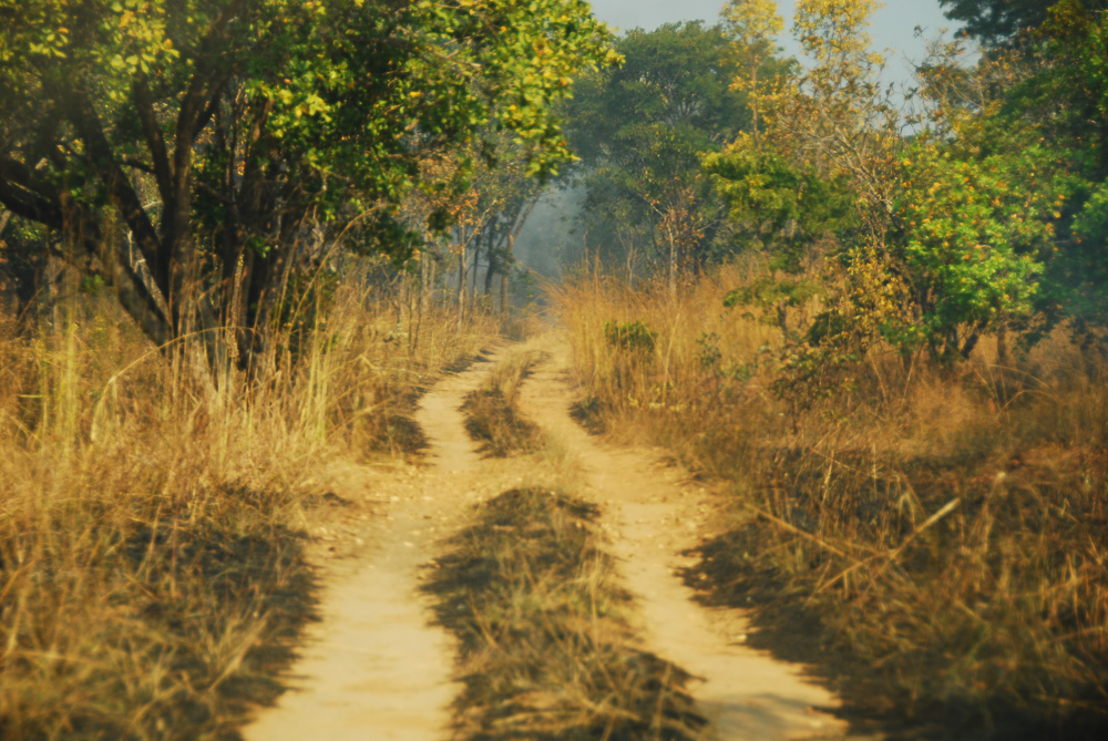
| The "road" to Bangweulu |
We had planned to drive as far as
Lake Waka Waka, a handy place to camp before the long slog to the Bangweulu
Wetlands the next day. We made our way
along a deteriorating dirt track, through a series of villages in which all the
children ran to the road to beg and eventually ran into a grass fire that had
us beating a rapid retreat until the flames abated. No sooner had we gotten through the fire than
we encountered a boggy river crossing, just short of Lake Waka Waka. We didn’t get out to scout the crossing, and
this turned out to be a serious error, as we promptly dropped a fairly long way
off the road and got ourselves completely mired in the mud with our
undercarriage firmly anchored. We tried
to drive out but only succeeded in digging ourselves in deeper. We got out the high-lift jack and the spade
and set to work trying to excavate ourselves, but the more we dug and jacked,
the less we got ourselves free of the bog.
Finally, after several hours of effort, we did what we should have done
immediately and Terri cycled off on her bike to the camp (which we knew from
the GPS was only 3 km away), while I stayed with the vehicle. It took a long time for her to return, and in
the meantime the sun set. I kept trying
to get out, but futility still reigned.
 |
| Our rescue squad at Lake Waka Waka |
Finally Terri came back in the pitch black, followed by 5 locals armed
with a pickaxe and a wood axe. They set
to work with alacrity and in about an hour and a half we had managed to jack
Stanley’s rear wheels up high enough (using a nifty jack extension that
Etienne, the former owner, had been far-sighted enough to buy) to put a lot of
logs underneath; the axes came in handy in trimming the logs to fit, while the
pickaxe and spade were used to excavate under the car. Eventually Terri climbed into the driver’s
seat while the rest of us pushed mightily and Stanley roared free of the mud and
out the other side of the crossing. We
cheered mightily, gathered up all the bits and pieces of equipment we could
find (except for a rubber mallet that disappeared mysteriously) and set off for
the camp, giving lifts to a couple of our helpers on the running board and in
the cramped confines of the back seat, while the other three rode
bicycles. We were bone-tired when we got
into Lake Waka Waka campground, but we still managed to heat up some stew and
rice over the fire, acutely aware that we had barely eaten since we had gotten
up. We paid each of our rescuers 50
kwacha (US$ 5), grateful that we weren’t spending the night in the swamp, and
they seemed satisfied with the money.
 |
| Terri and Jackson at Nsobe Camp |
We slept well and woke up to
beautiful scenery the next morning, with nice light on the lake surface and
lots of birds. We paid 100 kwacha per
person, rather excessive for the limited facilities, had a decent breakfast and
set off by 9:30 after repairing the damage of the night before (we had knocked
a hinge on a back compartment door loose, and had to remove the broken rivets
and replace them with zip ties) and washing the horrible-smelling mud off all
our rescue gear. Terri drove us along a
track that veered from wonderful to horrific and back again; there was a
section in the densely settled middle which had been properly graded and
engineered, while other bits more closely related the M14 to Muyombe. By 2 pm we had traversed the last of the
endless series of villages with their begging children (who also tried to jump
up on the back of Stanley, much to our annoyance) and emerged from the woods
into the endless flat short-grass plains.
We parked Stanley at Nsobe campsite, a bargain at 50 kwacha per person
per night, then got on our bicycles and rode over towards the wetlands
conservation office at Chikuni to find out what the deal was in terms of going
to look for the shoebill, the rare and prehistoric-looking bird for which the
wetlands are famous.
 |
| Bangweulu smoke-aided sunset |
The Bangweulu wetlands are pretty
dry this year, thanks to the epic drought, and it was easy riding over a flat,
dry plain. Pretty soon we spotted shapes
on the horizon which soon resolved themselves into hundreds of black lechwe,
another antelope species which we had never seen before. They were magnificent creatures with big
sweeping horns on the males, and they were massed in huge numbers around us; it
was faintly odd cycling through such a huge herd of animals. We also spotted ten white storks and got some
good photos of them flying. At Chikuni
we met Carl, a South African biologist working for African Parks, another
private organization rehabilitating wildlife areas in Africa, and found out the
deal. For 200 kwacha per group (US$ 20),
we could have as many guided tours into the swamps as necessary to find the
elusive shoebill. We arranged that we
would be back the next morning and cycled back across the plains, scaring up
clouds of pratincoles.
 |
| Black lechwe, Bangweulu |
The view from camp was magical
and a little alarming, with huge grassfires raging on the horizon, filling the
sky with smoke and making us wonder what would happen if the winds shifted and
sent the fire in our direction. The
campsite at Nsobe is widely spaced, so that we were barely aware of our
neighbours. Each campsite is on one of
the huge ancient termite mounds that rise slightly above the plain and provide
a spot for big shade trees to grow.
Again we had a big open fire to cook over, while another wood fire
provided hot water for showers for all the campers. We watched an impressive fireball sunset,
made more dramatic by all the smoke on the horizon, then ate and sat out under
the infinite dome of the night sky, sipping whisky and listening to the nearby
yelps of hyenas. If Pontoon Camp at
Kasanka was a perfect waterside campsite, Nsobe was a perfect open plain
campsite. We went to bed excited about
the prospect of seeing shoebills the next morning.
 |
| People silhouetted against grassfire smoke, Nsobe |
Shoebills are weird-looking,
rare, hard-to-spot birds that rank high on the list of must-see species in central
Africa for keen birders. I had first
heard of the bird while reading my Lonely Planet guidebook, and a subsequent
conversation with our Lusaka friend Vicky heightened our desire to see this
bird. We looked up the shoebill in a
YouTube clip from a David Attenborough nature special and were captivated (and
slightly repelled) by what we saw. We
knew that we had to see this bird in the wild, and hence the long (160 km) slog
off the main road to Nsobe.
 |
| Terri and a reed fishermen's shelter, Bangweulu |
We were excited on the morning of
Thursday, August 4
th as we woke up early and got on our bicycles for
the 8 km pedal across the plains to Chikuni.
Once there we realized that we were sharing the trip with a South
African couple, Ben and Suzanne, who had arrived at Nsobe the night before. It took a little while for them to pay and do
the paperwork for the trip, but by 7:45 we were walking away from Chikuni in
the company of two guides from Nsobe campsite towards the spot where one of the
two resident shoebills had been spotted the day before. It was a long walk to get there, mostly
across short-grass plains, but eventually the path led to the papyrus marshes
on the banks of a small river. As we
walked along, there were dozens of other bird species to be seen, including
various species of kingfisher, heron and egret and lots of Bohm’s
bee-eaters. We splashed across shallow
streams and balanced on mats of floating vegetation to get across deeper
water.
 |
| Poling through the reeds, Bangweulu |
Yellow-billed kites beat across
the marshes, searching out easy prey, as we trudged deeper into the marshes,
past the simple reed shelters built by local fishermen. It felt very timeless; we could almost have
been characters in a scene carved in an Egyptian Old Kingdom tomb, out fishing
and birding in the Nile marshes. We
asked directions from a group of fishermen and they gladly dropped what they
were doing and splashed out to join us. They were fishing for
boba, the primitive lungfish that lives in some profusion in the Bangweulu Wetlands and both provides a valuable export for the local community (well over a million US dollars is exported from the nearest village to the DRC every year) and constitutes the staple food of the shoebill. They claimed to know the whereabouts of the shoebill, and we followed
them on an obstacle course of tiny mokoros (dugout canoes), floating vegetation
rafts and tall reeds. At one point we
encountered another group of fishermen and a long animated discussion ensued,
with much head-scratching and casting around in various directions.
 |
| Fishermen's family, Bangweulu |
It turned out that the second group had scared
away the shoebill from its usual roost in the hopes of earning tips from
tourists (ie, us) by guiding us to the new roosting spot. We had a few false starts in various directions
before the joint efforts of the two parties of fishermen brought us to the
banks of a broad pond. We stared off
into the distance, trying to make out a shoebill on the other bank, and
suddenly there it was! A huge grey bird
stood half-concealed in the papyrus thicket, looking like a pterodactyl, its
bill huge and its eyes creepy with their opaque eyelids. He was hard to see,
buried as he was in the reeds. Two of
the fishermen waded across and tossed a fish in front of the shoebill, enticing
him out, and after a few minutes he walked a few steps forwards into the light.
We stood there for a quarter of an hour, studying the bird through our
binoculars and taking photos with our telephoto lenses. It was exhilarating to see the bird, one of
fewer than 10,000 in the world, but we were slightly too far away to take
decent pictures. Was it possible to get
closer?
 |
| Shoebill |
We put the question to our
guides, and they agreed that we could wade across. Terri and I went first, wading thigh-deep
through the water and then trying, with varying success, to float our weights
on the floating mats of interlocked vegetation.
I sank through a couple of times, but managed to stay upright and keep
the camera dry. Eventually we came to a
halt only 20 metres from the shoebill and paused to take much better close-up
photos. When we looked back, Suzanne was
following in our footsteps, wading through the reeds and making it successfully
to where we were standing. Ben, being a
big man, was dissuaded from following as he was certain to sink through the
reeds to the bottom. We stood looking at
the shoebill, feeling like time travellers back to the Cretaceous period,
watching him blink and turn his bill in various directions, trying to capture
the perfect image.
 |
| Boba lungfish, Bangweulu |
Eventually it was time to
return. It was a long wet slog back to
where we had left Ben and some of the fishermen, and then a much longer walk
along a different route back to Shoebill Island Camp, featuring a mokoro
crossing of the river made more complicated by the fact that there was only one
pole in the boat. Eventually we made it
to Shoebill, where we found a truck and lots of Kasanka Trust employees packing
up everything in the camp, including the toilets and the kitchen sinks, onto a
huge truck to take to another national park.
We hitched a lift back to Chikuni, where we picked up our bikes and rode
back to Nsobe.
 |
| Shoebill |
After a tasty lunch of corn fritters, we were tired by our early
wake-up call and the 10-kilometre swamp walk, so we took a little siesta up in
Stanley until 4 pm. When we got up, we
showered and then Terri created a tasty lentil stew on the open fire. As we were out of beer, I created whisky sour
cocktails to mark the sunset, another dramatic smoke-layered fireball, before
we tucked into the lentils with gusto.
After supper we went across to Ben and Suzanne’s campsite for champagne
and conversation with them and with Carl, the African Parks biologist. We sat around the campfire, watching the southern
stars dance overhead and swapping stories late into the night. We went to bed satisfied and content after a
perfect day of wildlife watching.
 |
| Campfire pancakes |
The next morning we slept until
7:30, tired by our late night and long day.
We got up, made pancakes on the open fire, did laundry and then set off
on bikes to pay for an extra night at Nsobe at the Chikuni office. It was a great bike ride across the huge
plain, scaring up clouds of collared pratincoles. We bought some delicious local honey at the
office, watched a massive martial eagle swoop down in pursuit of the rangers’
chickens, then biked off towards the
treeline in search of the elusive tsessebe.
We struck out on tsessebe, but ran across a group of ten wattled cranes,
a species that is very rare in much of its range but thrives in the Bangweulu
Wetlands. I got great shots of the cranes
in flight and then biked back to Nsobe in high spirits to try our hands at
baking using an open fire. Jackson, the
boss of Nsobe campsite, had excavated a small hole in the clayey soil to act as
an oven and found a couple of sheets of scrap corrugated iron, We stoked up the campfire and then
transferred the coals, along with some charcoal, to the hole to heat up our
bush oven, covered with the corrugated iron and another layer of coals. The oven worked brilliantly, and Terri was
able to cook up an exquisite lasagne in it.
 |
| Bangweulu fisherman |
We sat around drinking our last
beer and some leftover corn fritters while the lasagne cooked. I downloaded the photos from my camera to my
laptop and suddenly saw a strange error message. By the time I realized what was happening (a
virus was eating up my photos one by one), all the photos from the previous two
days were gone: the shoebill, the wattled
cranes, the black lechwe herds, the white storks. I was devastated, and sat there in saddened
shock for a long time. As we ate our
lasagne, we talked about what to do. We
decided that we would go out in search of shoebills again the following morning
before we drove out of Bangweulu. We
went to bed saddened by the technological failure, but excited to go out in
search of the shoebill again.
 |
| Cormorant, Bangweulu |
The following morning, Saturday
August 6
th, we got up early again and this time we pulled down
Stanley’s roof and drove to Chikuni.
This time there were no other tourists, and with only Terri and I in the
party, we moved pretty quickly out towards the shoebill. This time the guides had a pretty good idea
where the bird was going to be, and it took only an hour and twenty minutes to
get to its hideout, almost exactly where it was two days previously. We got even better photos this time, with the
shoebill walking and even flying briefly, and by 9:40 we were on our way back
to Stanley with two separate photo cards of images of the iconic bird. By 11:00 we were in the mokoro across the
river to Shoebill Island Camp, and by 11:30 we were in Stanley driving across
the plain in search of wattled cranes and white storks. We got great pictures of the huge black
lechwe herds and of the white storks, along with a few wooly-necked storks, but
we struck out on the wattled cranes. By
noon we were back in Nsobe, saying goodbye to Jackson and the other Nsobe
staff, and headed back along the track, exultant at having seen the shoebill a
second time.
 |
| Guide, fisherman, Terri and assistant guide (in Lungu T-shirt) |
The retreat to the D235 was
remarkably straightforward. We took
turns driving, and since we knew what was coming up, it was much easier driving than
on the way out. We managed to make it
the 160 km back to the main road without incident, driving smoothly through the
mud wallow that had swallowed us whole on the way out. We even found the missing mallet beside the mud hole, its wooden handle blackened by a grassfire that had swept over since we had last passed. We got to the main road before dark, even
after stopping to reflate the tires that we had deflated on the way out to
handle the sandy stretches. We weren’t
sure where to stop for the night, but an inspired guess saw us stop at the
Kasanka National Park gate and beg for a place to sleep. The guards let us camp for free just behind
the park gate barrier, and we slept deeply, full of leftover lasagne and tired
by another long, fulfilling day.
 |
| Black sparrowhawk, Bangweulu |
The following day, Sunday August
7
th, saw us drive a long but uneventful day along the deliciously
smooth asphalt of the T2 into Lusaka, past the closed customs offices of Kapiri
Mposhi, to the familiar confines of Nathalie’s house. It felt strange to be leaving behind the
wilds of northern Zambia where we had seen so many wonderful wild animals and
unforgettable landscapes and sunsets, and we were acutely aware that we might
never pass that way again. It had been a
wonderful 12 days in northern Zambia, and while we looked forward to the creature
comforts of the big city, we already missed the wide-open spaces and perfect
campsites of the north.
 |
| Terri cycling in Bangweulu |


